Weisweil geodata
Weisweil (Baden-Württemberg) is a seat of a fourth-order administrative division; located in Germany in Europe/Berlin (GMT+2) time zone. With population of 2,114 people, there are 4911 cities with bigger population in this country. Compared to other cities in Germany, 92.7% of cities are located further ↑North; 83.5% of cities are located further →East and 57.6% of cities have higher elevation than Weisweil. Note1
Administrative division(s):
- Level 1: Baden-Württemberg
- Level 2: Freiburg Region
- Level 3: Landkreis Emmendingen
- Level 4: Weisweil


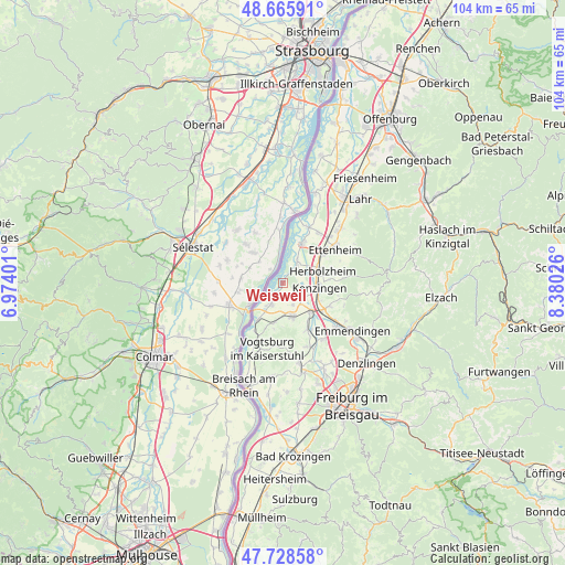
Weisweil GPS coordinates[2]
48° 11' 57.804" North, 7° 40' 37.668" East
| Map corner | latitude | longitude |
|---|---|---|
| Upper-left | 48.66591°, | 6.97401° |
| Center: | 48.19939°, | 7.67713° |
| Lower-right: | 47.72858°, | 8.38026° |
| Map W x H: | 104.2×104.2 km | = 64.7×64.7mi |
| max Lat: | 55.01917° ⇑92.7% North |
| Weisweil: | 48.19939° |
| min Lat: | ⇓7.3% South 47.40724° |
| min Long | Weisweil | max Long |
| 5.92978° | 7.67713° | 14.98853° |
| W 16.5%⇐ | ⇒83.5% E |
Elevation
Elevation of Weisweil is 170 m = 558 ft, and this is 79.1 m = 260 ft below average elevation for this country.
| Max E: |
1256 m = 4121 ft | 57.6% |
| Avg. | 249.1 m = 817 ft | |
| Weisweil | 170 m = 558 ft | |
Min E: |
-5 m = -16 ft | 42.4% |
See also: Germany elevation on elevation.city.
Geographical zone
Weisweil is located in North temperate zone (between Tropic of Cancer and the Arctic Circle). Distance of this North polar circle is 2041.9 km =1268.8 mi to North.| Distance of | km | miles | from Weisweil |
|---|---|---|---|
| North Pole | 4647.8 | 2888 | to North |
| Arctic Circle | 2041.9 | 1268.8 | to North |
| Tropic Cancer | 2753.4 | 1710.9 | to South |
| Equator | 5359.3 | 3330.1 | to South |


Nearby cities:
15 places around Weisweil: (largest is in red/bold)
• Bahlingen
9.9 km =6.2 mi,  152°
152°
• Bischoffingen
11.2 km =7 mi,  199°
199°
• Endingen
6.6 km =4.1 mi,  164°
164°
• Forchheim
4 km =2.5 mi, 155°
• Grafenhausen
11.5 km =7.1 mi,  35°
35°
• Herbolzheim
7.7 km =4.8 mi,  73°
73°
• Kappel-Grafenhausen
11.5 km =7.1 mi, 35°
• Kenzingen
6.9 km =4.3 mi,  92°
92°
• Malterdingen
9.3 km =5.8 mi,  120°
120°
• Riegel
7.6 km =4.7 mi,  135°
135°
• Ringsheim
9.2 km =5.7 mi,  54°
54°
• Rust
8.6 km =5.3 mi,  29°
29°
• Sasbach
8.2 km =5.1 mi,  213°
213°
• Vogtsburg
11.7 km =7.3 mi,  192°
192°
• Wyhl
4.2 km =2.6 mi, 209°
Sources, notices
• [Note1] Compared only with cities in Germany existing in our database
• [Src1] Map data: © OpenStreetMap contributors (CC-BY-SA)
• [Src2] Other city data from geonames.org with taken over terms of usage.
• [Src3] Geographical zone / Annual Mean Temperature by Robert A. Rohde @ Wikipedia
