Wattenheim geodata
Wattenheim (Rheinland-Pfalz) is a seat of a fourth-order administrative division; located in Germany in Europe/Berlin (GMT+2) time zone. With population of 1,632 people, there are 5633 cities with bigger population in this country. Compared to other cities in Germany, 75.3% of cities are located further ↑North; 76.1% of cities are located further →East and 66% of cities have lower elevation than Wattenheim. Note1
Administrative division(s):
- Level 1: Rheinland-Pfalz
- Level 3: Landkreis Bad Dürkheim
- Level 4: Wattenheim


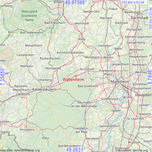
Wattenheim GPS coordinates[2]
49° 31' 18.012" North, 8° 3' 42.012" East
| Map corner | latitude | longitude |
|---|---|---|
| Upper-left | 49.97598°, | 7.35855° |
| Center: | 49.52167°, | 8.06167° |
| Lower-right: | 49.0631°, | 8.7648° |
| Map W x H: | 101.5×101.5 km | = 63.1×63.1mi |
| max Lat: | 55.01917° ⇑75.3% North |
| Wattenheim: | 49.52167° |
| min Lat: | ⇓24.7% South 47.40724° |
| min Long | Wattenheim | max Long |
| 5.92978° | 8.06167° | 14.98853° |
| W 23.9%⇐ | ⇒76.1% E |
Elevation
Elevation of Wattenheim is 328 m = 1076 ft, and this is 78.9 m = 259 ft above average elevation for this country.
| Max E: |
1256 m = 4121 ft | 34% |
| Wattenheim | 328 m 1076 ft | |
| Avg. | 249.1 m = 817 ft | |
Min E: |
-5 m = -16 ft | 66% |
See also: Germany elevation on elevation.city.
Geographical zone
Wattenheim is located in North temperate zone (between Tropic of Cancer and the Arctic Circle). Distance of this North polar circle is 1894.9 km =1177.4 mi to North.| Distance of | km | miles | from Wattenheim |
|---|---|---|---|
| North Pole | 4500.8 | 2796.7 | to North |
| Arctic Circle | 1894.9 | 1177.4 | to North |
| Tropic Cancer | 2900.4 | 1802.2 | to South |
| Equator | 5506.3 | 3421.5 | to South |


Nearby cities:
15 places around Wattenheim: (largest is in red/bold)
• Altleiningen
1.8 km =1.1 mi,  151°
151°
• Bobenheim am Berg
6.5 km =4 mi,  87°
87°
• Carlsberg
2.4 km =1.5 mi,  216°
216°
• Ebertsheim
6.2 km =3.9 mi,  33°
33°
• Eisenberg
4.2 km =2.6 mi,  10°
10°
• Hettenleidelheim
1.8 km =1.1 mi, 29°
• Kerzenheim
6.1 km =3.8 mi,  358°
358°
• Kleinkarlbach
6.6 km =4.1 mi,  73°
73°
• Lautersheim
7.8 km =4.8 mi,  19°
19°
• Mertesheim
7.7 km =4.8 mi,  43°
43°
• Neuleiningen
6 km =3.7 mi, 68°
• Ramsen
3.9 km =2.4 mi,  295°
295°
• Rodenbach
6.7 km =4.2 mi, 29°
• Tiefenthal
3.6 km =2.2 mi,  58°
58°
• Weisenheim am Berg
6.7 km =4.2 mi,  98°
98°
Sources, notices
• [Note1] Compared only with cities in Germany existing in our database
• [Src1] Map data: © OpenStreetMap contributors (CC-BY-SA)
• [Src2] Other city data from geonames.org with taken over terms of usage.
• [Src3] Geographical zone / Annual Mean Temperature by Robert A. Rohde @ Wikipedia
