Warberg geodata
Warberg (Lower Saxony) is a seat of a fourth-order administrative division; located in Germany in Europe/Berlin (GMT+2) time zone. With population of 978 people, there are 7253 cities with bigger population in this country. Compared to other cities in Germany, 73.8% of cities are located further ↓South; 65.8% of cities are located further ←West and 60.6% of cities have higher elevation than Warberg. Note1


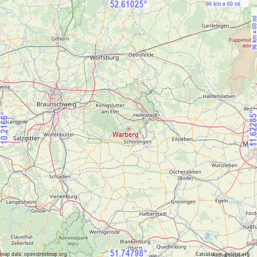
Warberg GPS coordinates[2]
52° 10' 52.32" North, 10° 55' 10.992" East
| Map corner | latitude | longitude |
|---|---|---|
| Upper-left | 52.61025°, | 10.2166° |
| Center: | 52.1812°, | 10.91972° |
| Lower-right: | 51.74798°, | 11.62285° |
| Map W x H: | 95.9×95.9 km | = 59.6×59.6mi |
| max Lat: | 55.01917° ⇑26.2% North |
| Warberg: | 52.1812° |
| min Lat: | ⇓73.8% South 47.40724° |
| min Long | Warberg | max Long |
| 5.92978° | 10.91972° | 14.98853° |
| W 65.8%⇐ | ⇒34.2% E |
Elevation
Elevation of Warberg is 148 m = 486 ft, and this is 101.1 m = 332 ft below average elevation for this country.
| Max E: |
1256 m = 4121 ft | 60.6% |
| Avg. | 249.1 m = 817 ft | |
| Warberg | 148 m = 486 ft | |
Min E: |
-5 m = -16 ft | 39.4% |
See also: Germany elevation on elevation.city.
Geographical zone
Warberg is located in North temperate zone (between Tropic of Cancer and the Arctic Circle). Distance of this North polar circle is 1599.2 km =993.7 mi to North.| Distance of | km | miles | from Warberg |
|---|---|---|---|
| North Pole | 4205.1 | 2612.9 | to North |
| Arctic Circle | 1599.2 | 993.7 | to North |
| Tropic Cancer | 3196.1 | 1986 | to South |
| Equator | 5802 | 3605.2 | to South |


Nearby cities:
15 places around Warberg: (largest is in red/bold)
• Büddenstedt
6.9 km =4.3 mi,  100°
100°
• Dahlum
7.1 km =4.4 mi,  221°
221°
• Frellstedt
2.7 km =1.7 mi,  353°
353°
• Harbke
8.7 km =5.4 mi,  84°
84°
• Helmstedt
8 km =5 mi,  49°
49°
• Hötensleben
9.8 km =6.1 mi,  134°
134°
• Ingeleben
8.9 km =5.5 mi,  200°
200°
• Königslutter am Elm
10.5 km =6.5 mi,  317°
317°
• Räbke
3.2 km =2 mi,  300°
300°
• Schöningen
5.8 km =3.6 mi,  145°
145°
• Söllingen
10.2 km =6.3 mi,  177°
177°
• Süpplingen
5.3 km =3.3 mi, 348°
• Süpplingenburg
7.8 km =4.8 mi,  355°
355°
• Twieflingen
6.3 km =3.9 mi, 181°
• Wolsdorf
1.7 km =1.1 mi, 50°
Sources, notices
• [Note1] Compared only with cities in Germany existing in our database
• [Src1] Map data: © OpenStreetMap contributors (CC-BY-SA)
• [Src2] Other city data from geonames.org with taken over terms of usage.
• [Src3] Geographical zone / Annual Mean Temperature by Robert A. Rohde @ Wikipedia
