Frellstedt geodata
Frellstedt (Lower Saxony) is a seat of a fourth-order administrative division; located in Germany in Europe/Berlin (GMT+2) time zone. With population of 862 people, there are 7654 cities with bigger population in this country. Compared to other cities in Germany, 74.1% of cities are located further ↓South; 65.7% of cities are located further ←West and 65% of cities have higher elevation than Frellstedt. Note1


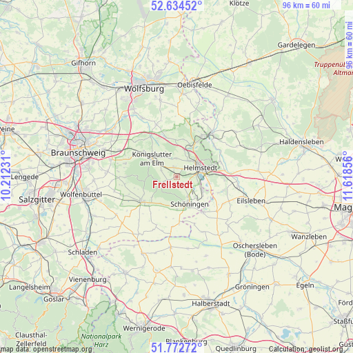
Frellstedt GPS coordinates[2]
52° 12' 20.556" North, 10° 54' 55.548" East
| Map corner | latitude | longitude |
|---|---|---|
| Upper-left | 52.63452°, | 10.21231° |
| Center: | 52.20571°, | 10.91543° |
| Lower-right: | 51.77272°, | 11.61856° |
| Map W x H: | 95.8×95.8 km | = 59.5×59.5mi |
| max Lat: | 55.01917° ⇑25.9% North |
| Frellstedt: | 52.20571° |
| min Lat: | ⇓74.1% South 47.40724° |
| min Long | Frellstedt | max Long |
| 5.92978° | 10.91543° | 14.98853° |
| W 65.7%⇐ | ⇒34.3% E |
Elevation
Elevation of Frellstedt is 120 m = 394 ft, and this is 129.1 m = 424 ft below average elevation for this country.
| Max E: |
1256 m = 4121 ft | 65% |
| Avg. | 249.1 m = 817 ft | |
| Frellstedt | 120 m = 394 ft | |
Min E: |
-5 m = -16 ft | 35% |
See also: Germany elevation on elevation.city.
Geographical zone
Frellstedt is located in North temperate zone (between Tropic of Cancer and the Arctic Circle). Distance of this North polar circle is 1596.4 km =992 mi to North.| Distance of | km | miles | from Frellstedt |
|---|---|---|---|
| North Pole | 4202.3 | 2611.2 | to North |
| Arctic Circle | 1596.4 | 992 | to North |
| Tropic Cancer | 3198.8 | 1987.6 | to South |
| Equator | 5804.7 | 3606.9 | to South |


Nearby cities:
15 places around Frellstedt: (largest is in red/bold)
• Büddenstedt
8.1 km =5 mi,  119°
119°
• Dahlum
9.2 km =5.7 mi,  209°
209°
• Harbke
9.1 km =5.7 mi,  101°
101°
• Helmstedt
6.9 km =4.3 mi,  69°
69°
• Kneitlingen
11 km =6.8 mi,  251°
251°
• Königslutter am Elm
8.4 km =5.2 mi,  306°
306°
• Mariental
9.1 km =5.7 mi,  30°
30°
• Rennau
10 km =6.2 mi,  358°
358°
• Räbke
2.7 km =1.7 mi, 246°
• Schöningen
8.3 km =5.2 mi,  154°
154°
• Süpplingen
2.6 km =1.6 mi,  342°
342°
• Süpplingenburg
5 km =3.1 mi, 355°
• Twieflingen
9 km =5.6 mi,  179°
179°
• Warberg
2.7 km =1.7 mi,  173°
173°
• Wolsdorf
2.3 km =1.4 mi,  135°
135°
Sources, notices
• [Note1] Compared only with cities in Germany existing in our database
• [Src1] Map data: © OpenStreetMap contributors (CC-BY-SA)
• [Src2] Other city data from geonames.org with taken over terms of usage.
• [Src3] Geographical zone / Annual Mean Temperature by Robert A. Rohde @ Wikipedia
