Waldmohr geodata
Waldmohr (Rheinland-Pfalz) is a seat of a fourth-order administrative division; located in Germany in Europe/Berlin (GMT+2) time zone. With population of 5,426 people, there are 2658 cities with bigger population in this country. Compared to other cities in Germany, 77.4% of cities are located further ↑North; 89.6% of cities are located further →East and 56.7% of cities have lower elevation than Waldmohr. Note1


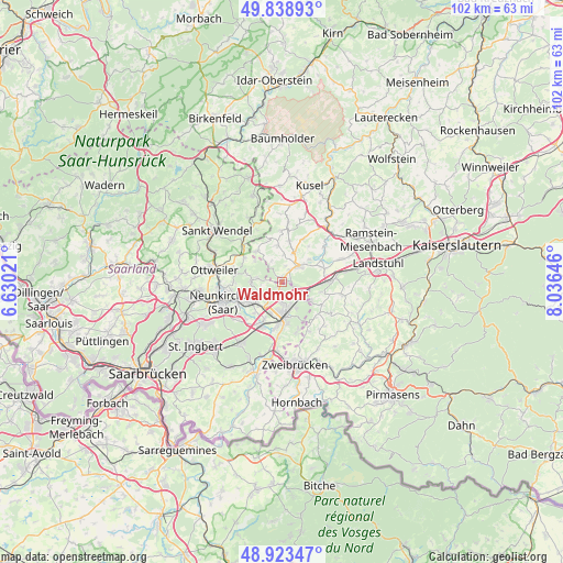
Waldmohr GPS coordinates[2]
49° 22' 59.988" North, 7° 19' 59.988" East
| Map corner | latitude | longitude |
|---|---|---|
| Upper-left | 49.83893°, | 6.63021° |
| Center: | 49.38333°, | 7.33333° |
| Lower-right: | 48.92347°, | 8.03646° |
| Map W x H: | 101.8×101.8 km | = 63.3×63.3mi |
| max Lat: | 55.01917° ⇑77.4% North |
| Waldmohr: | 49.38333° |
| min Lat: | ⇓22.6% South 47.40724° |
| min Long | Waldmohr | max Long |
| 5.92978° | 7.33333° | 14.98853° |
| W 10.4%⇐ | ⇒89.6% E |
Elevation
Elevation of Waldmohr is 270 m = 886 ft, and this is 20.9 m = 69 ft above average elevation for this country.
| Max E: |
1256 m = 4121 ft | 43.3% |
| Waldmohr | 270 m 886 ft | |
| Avg. | 249.1 m = 817 ft | |
Min E: |
-5 m = -16 ft | 56.7% |
See also: Germany elevation on elevation.city.
Geographical zone
Waldmohr is located in North temperate zone (between Tropic of Cancer and the Arctic Circle). Distance of this North polar circle is 1910.3 km =1187 mi to North.| Distance of | km | miles | from Waldmohr |
|---|---|---|---|
| North Pole | 4516.2 | 2806.2 | to North |
| Arctic Circle | 1910.3 | 1187 | to North |
| Tropic Cancer | 2885 | 1792.7 | to South |
| Equator | 5490.9 | 3411.9 | to South |


Nearby cities:
15 places around Waldmohr: (largest is in red/bold)
• Altenkirchen
6.7 km =4.2 mi,  352°
352°
• Bechhofen
6.1 km =3.8 mi,  127°
127°
• Bexbach
7 km =4.3 mi,  233°
233°
• Breitenbach
7.4 km =4.6 mi,  319°
319°
• Bruchmühlbach-Miesau
7.2 km =4.5 mi,  90°
90°
• Brücken
5.7 km =3.5 mi,  19°
19°
• Börsborn
7.4 km =4.6 mi,  40°
40°
• Dittweiler
5.2 km =3.2 mi,  1°
1°
• Dunzweiler
4.1 km =2.5 mi,  330°
330°
• Gries
6.1 km =3.8 mi,  52°
52°
• Homburg
6.3 km =3.9 mi,  176°
176°
• Lambsborn
7.5 km =4.7 mi,  104°
104°
• Ohmbach
7.5 km =4.7 mi,  9°
9°
• Rosenkopf
8.1 km =5 mi,  117°
117°
• Schönenberg-Kübelberg
3.9 km =2.4 mi, 46°
Sources, notices
• [Note1] Compared only with cities in Germany existing in our database
• [Src1] Map data: © OpenStreetMap contributors (CC-BY-SA)
• [Src2] Other city data from geonames.org with taken over terms of usage.
• [Src3] Geographical zone / Annual Mean Temperature by Robert A. Rohde @ Wikipedia
