Breitenbach geodata
Breitenbach (Rheinland-Pfalz) is a seat of a fourth-order administrative division; located in Germany in Europe/Berlin (GMT+2) time zone. In our database, there are 11009 cities with bigger population. Compared to other cities in Germany, 76.8% of cities are located further ↑North; 90.6% of cities are located further →East and 69.4% of cities have lower elevation than Breitenbach. Note1


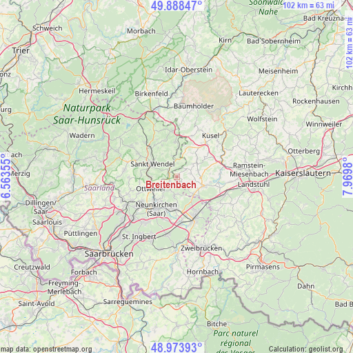
Breitenbach GPS coordinates[2]
49° 25' 59.988" North, 7° 16' 0.012" East
| Map corner | latitude | longitude |
|---|---|---|
| Upper-left | 49.88847°, | 6.56355° |
| Center: | 49.43333°, | 7.26667° |
| Lower-right: | 48.97393°, | 7.9698° |
| Map W x H: | 101.7×101.7 km | = 63.2×63.2mi |
| max Lat: | 55.01917° ⇑76.8% North |
| Breitenbach: | 49.43333° |
| min Lat: | ⇓23.2% South 47.40724° |
| min Long | Breitenbach | max Long |
| 5.92978° | 7.26667° | 14.98853° |
| W 9.4%⇐ | ⇒90.6% E |
Elevation
Elevation of Breitenbach is 354 m = 1161 ft, and this is 104.9 m = 344 ft above average elevation for this country.
| Max E: |
1256 m = 4121 ft | 30.6% |
| Breitenbach | 354 m 1161 ft | |
| Avg. | 249.1 m = 817 ft | |
Min E: |
-5 m = -16 ft | 69.4% |
See also: Germany elevation on elevation.city.
Geographical zone
Breitenbach is located in North temperate zone (between Tropic of Cancer and the Arctic Circle). Distance of this North polar circle is 1904.7 km =1183.5 mi to North.| Distance of | km | miles | from Breitenbach |
|---|---|---|---|
| North Pole | 4510.6 | 2802.8 | to North |
| Arctic Circle | 1904.7 | 1183.5 | to North |
| Tropic Cancer | 2890.6 | 1796.1 | to South |
| Equator | 5496.5 | 3415.4 | to South |


Nearby cities:
15 places around Breitenbach: (largest is in red/bold)
• Altenkirchen
4.1 km =2.5 mi,  74°
74°
• Brücken
6.7 km =4.2 mi,  91°
91°
• Dittweiler
5 km =3.1 mi, 93°
• Dunzweiler
3.4 km =2.1 mi,  124°
124°
• Frohnhofen
3.3 km =2.1 mi,  46°
46°
• Hangard
7 km =4.3 mi,  215°
215°
• Herschweiler-Pettersheim
8.2 km =5.1 mi, 47°
• Krottelbach
6.1 km =3.8 mi, 52°
• Langenbach
8 km =5 mi,  33°
33°
• Ohmbach
6.3 km =3.9 mi, 72°
• Ottweiler
8.2 km =5.1 mi,  244°
244°
• Sankt Wendel
8 km =5 mi,  297°
297°
• Schönenberg-Kübelberg
8.2 km =5.1 mi,  110°
110°
• Selchenbach
7.8 km =4.8 mi,  17°
17°
• Waldmohr
7.4 km =4.6 mi,  139°
139°
Sources, notices
• [Note1] Compared only with cities in Germany existing in our database
• [Src1] Map data: © OpenStreetMap contributors (CC-BY-SA)
• [Src2] Other city data from geonames.org with taken over terms of usage.
• [Src3] Geographical zone / Annual Mean Temperature by Robert A. Rohde @ Wikipedia
