Waldleiningen geodata
Waldleiningen (Rheinland-Pfalz) is a seat of a fourth-order administrative division; located in Germany in Europe/Berlin (GMT+2) time zone. With population of 453 people, there are 9526 cities with bigger population in this country. Compared to other cities in Germany, 77.2% of cities are located further ↑North; 79.4% of cities are located further →East and 66.2% of cities have lower elevation than Waldleiningen. Note1
Administrative division(s):
- Level 1: Rheinland-Pfalz
- Level 3: Landkreis Kaiserslautern
- Level 4: Waldleiningen


Waldleiningen GPS coordinates[2]
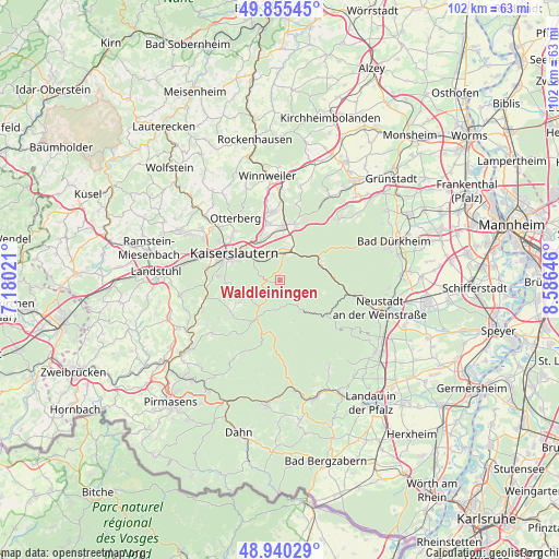
49° 24' 0" North, 7° 52' 59.988" East
| Map corner | latitude | longitude |
|---|---|---|
| Upper-left | 49.85545°, | 7.18021° |
| Center: | 49.4°, | 7.88333° |
| Lower-right: | 48.94029°, | 8.58646° |
| Map W x H: | 101.8×101.8 km | = 63.3×63.3mi |
| max Lat: | 55.01917° ⇑77.2% North |
| Waldleiningen: | 49.4° |
| min Lat: | ⇓22.8% South 47.40724° |
| min Long | Waldleiningen | max Long |
| 5.92978° | 7.88333° | 14.98853° |
| W 20.6%⇐ | ⇒79.4% E |
Elevation
Elevation of Waldleiningen is 330 m = 1083 ft, and this is 80.9 m = 265 ft above average elevation for this country.
| Max E: |
1256 m = 4121 ft | 33.8% |
| Waldleiningen | 330 m 1083 ft | |
| Avg. | 249.1 m = 817 ft | |
Min E: |
-5 m = -16 ft | 66.2% |
See also: Germany elevation on elevation.city.
Geographical zone
Waldleiningen is located in North temperate zone (between Tropic of Cancer and the Arctic Circle). Distance of this North polar circle is 1908.4 km =1185.8 mi to North.| Distance of | km | miles | from Waldleiningen |
|---|---|---|---|
| North Pole | 4514.3 | 2805.1 | to North |
| Arctic Circle | 1908.4 | 1185.8 | to North |
| Tropic Cancer | 2886.8 | 1793.8 | to South |
| Equator | 5492.8 | 3413.1 | to South |


Nearby cities:
15 places around Waldleiningen: (largest is in red/bold)
• Elmstein
5.2 km =3.2 mi,  135°
135°
• Enkenbach-Alsenborn
9.3 km =5.8 mi,  7°
7°
• Esthal
7.5 km =4.7 mi,  104°
104°
• Fischbach
6.1 km =3.8 mi,  23°
23°
• Frankeneck
12.2 km =7.6 mi, 102°
• Frankenstein
8.1 km =5 mi,  56°
56°
• Hochspeyer
4.8 km =3 mi, 10°
• Kaiserslautern
9.4 km =5.8 mi,  300°
300°
• Mehlingen
10.4 km =6.5 mi,  348°
348°
• Neidenfels
11.9 km =7.4 mi, 95°
• Schmalenberg
13.1 km =8.1 mi,  235°
235°
• Sembach
12.5 km =7.8 mi, 354°
• Stelzenberg
10.8 km =6.7 mi,  256°
256°
• Trippstadt
9.1 km =5.7 mi, 240°
• Weidenthal
8.6 km =5.3 mi,  77°
77°
Sources, notices
• [Note1] Compared only with cities in Germany existing in our database
• [Src1] Map data: © OpenStreetMap contributors (CC-BY-SA)
• [Src2] Other city data from geonames.org with taken over terms of usage.
• [Src3] Geographical zone / Annual Mean Temperature by Robert A. Rohde @ Wikipedia
