Wagenhoff geodata
Wagenhoff (Lower Saxony) is a seat of a fourth-order administrative division; located in Germany in Europe/Berlin (GMT+2) time zone. With population of 1,150 people, there are 6699 cities with bigger population in this country. Compared to other cities in Germany, 78.1% of cities are located further ↓South; 59.3% of cities are located further ←West and 76.1% of cities have higher elevation than Wagenhoff. Note1


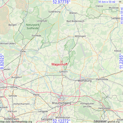
Wagenhoff GPS coordinates[2]
52° 33' 8.388" North, 10° 31' 24.132" East
| Map corner | latitude | longitude |
|---|---|---|
| Upper-left | 52.97778°, | 9.82025° |
| Center: | 52.55233°, | 10.52337° |
| Lower-right: | 52.12272°, | 11.2265° |
| Map W x H: | 95.1×95.1 km | = 59.1×59.1mi |
| max Lat: | 55.01917° ⇑21.9% North |
| Wagenhoff: | 52.55233° |
| min Lat: | ⇓78.1% South 47.40724° |
| min Long | Wagenhoff | max Long |
| 5.92978° | 10.52337° | 14.98853° |
| W 59.3%⇐ | ⇒40.7% E |
Elevation
Elevation of Wagenhoff is 59 m = 194 ft, and this is 190.1 m = 624 ft below average elevation for this country.
| Max E: |
1256 m = 4121 ft | 76.1% |
| Avg. | 249.1 m = 817 ft | |
| Wagenhoff | 59 m = 194 ft | |
Min E: |
-5 m = -16 ft | 23.9% |
See also: Germany elevation on elevation.city.
Geographical zone
Wagenhoff is located in North temperate zone (between Tropic of Cancer and the Arctic Circle). Distance of this North polar circle is 1557.9 km =968 mi to North.| Distance of | km | miles | from Wagenhoff |
|---|---|---|---|
| North Pole | 4163.8 | 2587.3 | to North |
| Arctic Circle | 1557.9 | 968 | to North |
| Tropic Cancer | 3237.4 | 2011.6 | to South |
| Equator | 5843.3 | 3630.9 | to South |


Nearby cities:
15 places around Wagenhoff: (largest is in red/bold)
• Bokensdorf
14.3 km =8.9 mi,  113°
113°
• Gifhorn
8.5 km =5.3 mi,  167°
167°
• Groß Oesingen
11.3 km =7 mi,  339°
339°
• Hohne
10.7 km =6.6 mi,  291°
291°
• Isenbüttel
13.8 km =8.6 mi,  162°
162°
• Leiferde
13.9 km =8.6 mi,  205°
205°
• Meinersen
14.5 km =9 mi,  233°
233°
• Müden
11.4 km =7.1 mi,  256°
256°
• Osloß
14.1 km =8.8 mi,  131°
131°
• Ribbesbüttel
13.1 km =8.1 mi,  183°
183°
• Sassenburg
8.4 km =5.2 mi,  118°
118°
• Schönewörde
11.7 km =7.3 mi,  39°
39°
• Ummern
7.5 km =4.7 mi,  304°
304°
• Wahrenholz
8.8 km =5.5 mi, 35°
• Wesendorf
5.3 km =3.3 mi,  7°
7°
Sources, notices
• [Note1] Compared only with cities in Germany existing in our database
• [Src1] Map data: © OpenStreetMap contributors (CC-BY-SA)
• [Src2] Other city data from geonames.org with taken over terms of usage.
• [Src3] Geographical zone / Annual Mean Temperature by Robert A. Rohde @ Wikipedia
