Wachenroth geodata
Wachenroth (Bavaria) is a populated place; located in Germany in Europe/Berlin (GMT+2) time zone. With population of 2,205 people, there are 4796 cities with bigger population in this country. Compared to other cities in Germany, 70.1% of cities are located further ↑North; 62.7% of cities are located further ←West and 60.7% of cities have lower elevation than Wachenroth. Note1
Administrative division(s):
- Level 1: Bavaria
- Level 2: Regierungsbezirk Mittelfranken
- Level 3: Landkreis Erlangen-Höchstadt
- Level 4: Wachenroth, Markt


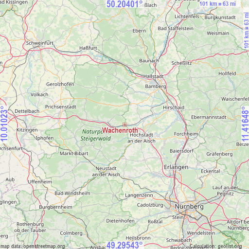
Wachenroth GPS coordinates[2]
49° 45' 6.66" North, 10° 42' 48.06" East
| Map corner | latitude | longitude |
|---|---|---|
| Upper-left | 50.20401°, | 10.01023° |
| Center: | 49.75185°, | 10.71335° |
| Lower-right: | 49.29543°, | 11.41648° |
| Map W x H: | 101×101 km | = 62.8×62.8mi |
| max Lat: | 55.01917° ⇑70.1% North |
| Wachenroth: | 49.75185° |
| min Lat: | ⇓29.9% South 47.40724° |
| min Long | Wachenroth | max Long |
| 5.92978° | 10.71335° | 14.98853° |
| W 62.7%⇐ | ⇒37.3% E |
Elevation
Elevation of Wachenroth is 294 m = 965 ft, and this is 44.9 m = 147 ft above average elevation for this country.
| Max E: |
1256 m = 4121 ft | 39.3% |
| Wachenroth | 294 m 965 ft | |
| Avg. | 249.1 m = 817 ft | |
Min E: |
-5 m = -16 ft | 60.7% |
See also: Germany elevation on elevation.city.
Geographical zone
Wachenroth is located in North temperate zone (between Tropic of Cancer and the Arctic Circle). Distance of this North polar circle is 1869.3 km =1161.5 mi to North.| Distance of | km | miles | from Wachenroth |
|---|---|---|---|
| North Pole | 4475.2 | 2780.8 | to North |
| Arctic Circle | 1869.3 | 1161.5 | to North |
| Tropic Cancer | 2926 | 1818.1 | to South |
| Equator | 5531.9 | 3437.4 | to South |


Nearby cities:
15 places around Wachenroth: (largest is in red/bold)
• Burgebrach
8.8 km =5.5 mi,  14°
14°
• Burghaslach
8.4 km =5.2 mi,  255°
255°
• Burgwindheim
11.9 km =7.4 mi,  314°
314°
• Frensdorf
13.2 km =8.2 mi,  56°
56°
• Gerhardshofen
13.5 km =8.4 mi,  186°
186°
• Gremsdorf
10.6 km =6.6 mi,  126°
126°
• Höchstadt an der Aisch
8.8 km =5.5 mi, 125°
• Lonnerstadt
7 km =4.3 mi,  146°
146°
• Markt Taschendorf
12.7 km =7.9 mi,  243°
243°
• Mühlhausen
4.5 km =2.8 mi,  86°
86°
• Pommersfelden
7.6 km =4.7 mi,  77°
77°
• Schlüsselfeld
6.8 km =4.2 mi,  274°
274°
• Uehlfeld
9 km =5.6 mi,  176°
176°
• Vestenbergsgreuth
8.4 km =5.2 mi,  211°
211°
• Walsdorf
13.7 km =8.5 mi,  21°
21°
Sources, notices
• [Note1] Compared only with cities in Germany existing in our database
• [Src1] Map data: © OpenStreetMap contributors (CC-BY-SA)
• [Src2] Other city data from geonames.org with taken over terms of usage.
• [Src3] Geographical zone / Annual Mean Temperature by Robert A. Rohde @ Wikipedia
