Uehlfeld geodata
Uehlfeld (Bavaria) is a populated place; located in Germany in Europe/Berlin (GMT+2) time zone. With population of 2,908 people, there are 4084 cities with bigger population in this country. Compared to other cities in Germany, 72% of cities are located further ↑North; 62.8% of cities are located further ←West and 58.7% of cities have lower elevation than Uehlfeld. Note1
Administrative division(s):
- Level 1: Bavaria
- Level 2: Regierungsbezirk Mittelfranken
- Level 3: Landkreis Neustadt an der Aisch-Bad Windsheim
- Level 4: Uehlfeld, Markt


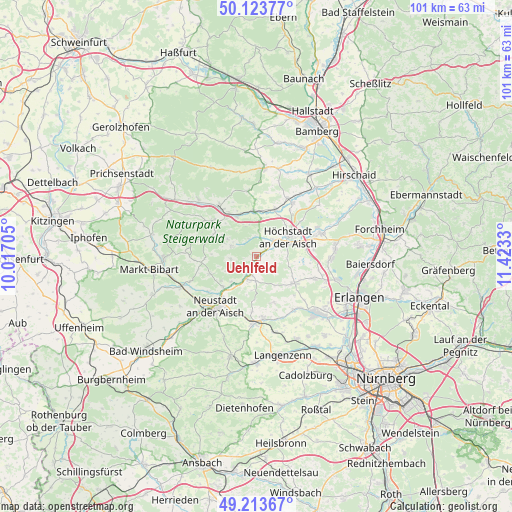
Uehlfeld GPS coordinates[2]
49° 40' 15.06" North, 10° 43' 12.612" East
| Map corner | latitude | longitude |
|---|---|---|
| Upper-left | 50.12377°, | 10.01705° |
| Center: | 49.67085°, | 10.72017° |
| Lower-right: | 49.21367°, | 11.4233° |
| Map W x H: | 101.2×101.2 km | = 62.9×62.9mi |
| max Lat: | 55.01917° ⇑72% North |
| Uehlfeld: | 49.67085° |
| min Lat: | ⇓28% South 47.40724° |
| min Long | Uehlfeld | max Long |
| 5.92978° | 10.72017° | 14.98853° |
| W 62.8%⇐ | ⇒37.2% E |
Elevation
Elevation of Uehlfeld is 282 m = 925 ft, and this is 32.9 m = 108 ft above average elevation for this country.
| Max E: |
1256 m = 4121 ft | 41.3% |
| Uehlfeld | 282 m 925 ft | |
| Avg. | 249.1 m = 817 ft | |
Min E: |
-5 m = -16 ft | 58.7% |
See also: Germany elevation on elevation.city.
Geographical zone
Uehlfeld is located in North temperate zone (between Tropic of Cancer and the Arctic Circle). Distance of this North polar circle is 1878.3 km =1167.1 mi to North.| Distance of | km | miles | from Uehlfeld |
|---|---|---|---|
| North Pole | 4484.2 | 2786.4 | to North |
| Arctic Circle | 1878.3 | 1167.1 | to North |
| Tropic Cancer | 2917 | 1812.5 | to South |
| Equator | 5522.9 | 3431.8 | to South |


Nearby cities:
15 places around Uehlfeld: (largest is in red/bold)
• Burghaslach
11 km =6.8 mi,  308°
308°
• Diespeck
10.1 km =6.3 mi,  218°
218°
• Gerhardshofen
4.9 km =3 mi,  205°
205°
• Gremsdorf
8.5 km =5.3 mi,  71°
71°
• Großenseebach
11.9 km =7.4 mi,  110°
110°
• Gutenstetten
8.7 km =5.4 mi,  226°
226°
• Höchstadt an der Aisch
7.8 km =4.8 mi,  59°
59°
• Lonnerstadt
4.6 km =2.9 mi,  47°
47°
• Mühlhausen
10.1 km =6.3 mi,  23°
23°
• Münchsteinach
9.7 km =6 mi,  248°
248°
• Oberreichenbach
9.7 km =6 mi,  158°
158°
• Vestenbergsgreuth
5.3 km =3.3 mi,  290°
290°
• Wachenroth
9 km =5.6 mi,  356°
356°
• Weisendorf
9.3 km =5.8 mi,  125°
125°
• Wilhelmsdorf
11.9 km =7.4 mi,  174°
174°
Sources, notices
• [Note1] Compared only with cities in Germany existing in our database
• [Src1] Map data: © OpenStreetMap contributors (CC-BY-SA)
• [Src2] Other city data from geonames.org with taken over terms of usage.
• [Src3] Geographical zone / Annual Mean Temperature by Robert A. Rohde @ Wikipedia
