Schlüsselfeld geodata
Schlüsselfeld (Bavaria) is a populated place; located in Germany in Europe/Berlin (GMT+2) time zone. With population of 5,848 people, there are 2507 cities with bigger population in this country. Compared to other cities in Germany, 70% of cities are located further ↑North; 61.2% of cities are located further ←West and 61.3% of cities have lower elevation than Schlüsselfeld. Note1
Administrative division(s):
- Level 1: Bavaria
- Level 2: Upper Franconia
- Level 3: Landkreis Bamberg
- Level 4: Schlüsselfeld


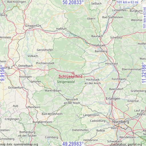
Schlüsselfeld GPS coordinates[2]
49° 45' 22.356" North, 10° 37' 7.428" East
| Map corner | latitude | longitude |
|---|---|---|
| Upper-left | 50.20833°, | 9.9156° |
| Center: | 49.75621°, | 10.61873° |
| Lower-right: | 49.29983°, | 11.32186° |
| Map W x H: | 101×101 km | = 62.8×62.8mi |
| max Lat: | 55.01917° ⇑70% North |
| Schlüsselfeld: | 49.75621° |
| min Lat: | ⇓30% South 47.40724° |
| min Long | Schlüsselfeld | max Long |
| 5.92978° | 10.61873° | 14.98853° |
| W 61.2%⇐ | ⇒38.8% E |
Elevation
Elevation of Schlüsselfeld is 298 m = 978 ft, and this is 48.9 m = 160 ft above average elevation for this country.
| Max E: |
1256 m = 4121 ft | 38.7% |
| Schlüsselfeld | 298 m 978 ft | |
| Avg. | 249.1 m = 817 ft | |
Min E: |
-5 m = -16 ft | 61.3% |
See also: Germany elevation on elevation.city.
Geographical zone
Schlüsselfeld is located in North temperate zone (between Tropic of Cancer and the Arctic Circle). Distance of this North polar circle is 1868.8 km =1161.2 mi to North.| Distance of | km | miles | from Schlüsselfeld |
|---|---|---|---|
| North Pole | 4474.7 | 2780.4 | to North |
| Arctic Circle | 1868.8 | 1161.2 | to North |
| Tropic Cancer | 2926.5 | 1818.4 | to South |
| Equator | 5532.4 | 3437.7 | to South |


Nearby cities:
15 places around Schlüsselfeld: (largest is in red/bold)
• Burgebrach
12 km =7.5 mi,  48°
48°
• Burghaslach
2.9 km =1.8 mi,  206°
206°
• Burgwindheim
8.1 km =5 mi,  348°
348°
• Geiselwind
10.8 km =6.7 mi,  280°
280°
• Gerhardshofen
14.8 km =9.2 mi,  159°
159°
• Lonnerstadt
12.4 km =7.7 mi,  120°
120°
• Markt Taschendorf
7.6 km =4.7 mi,  216°
216°
• Mühlhausen
11.3 km =7 mi,  91°
91°
• Münchsteinach
13.1 km =8.1 mi,  187°
187°
• Oberscheinfeld
14.3 km =8.9 mi,  248°
248°
• Pommersfelden
14.3 km =8.9 mi, 85°
• Scheinfeld
14.7 km =9.1 mi,  228°
228°
• Uehlfeld
12 km =7.5 mi,  142°
142°
• Vestenbergsgreuth
8 km =5 mi, 162°
• Wachenroth
6.8 km =4.2 mi, 94°
Sources, notices
• [Note1] Compared only with cities in Germany existing in our database
• [Src1] Map data: © OpenStreetMap contributors (CC-BY-SA)
• [Src2] Other city data from geonames.org with taken over terms of usage.
• [Src3] Geographical zone / Annual Mean Temperature by Robert A. Rohde @ Wikipedia
