Wabern geodata
Wabern (Hesse) is a seat of a fourth-order administrative division; located in Germany in Europe/Berlin (GMT+2) time zone. With population of 7,708 people, there are 2010 cities with bigger population in this country. Compared to other cities in Germany, 59.9% of cities are located further ↓South; 60.1% of cities are located further →East and 58.3% of cities have higher elevation than Wabern. Note1
Administrative division(s):
- Level 1: Hesse
- Level 2: Regierungsbezirk Kassel
- Level 3: Schwalm-Eder-Kreis
- Level 4: Wabern


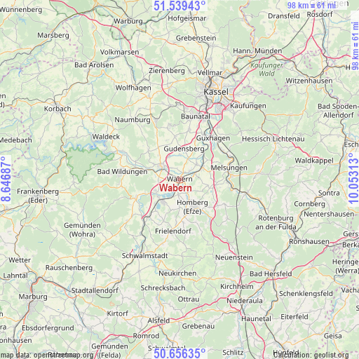
Wabern GPS coordinates[2]
51° 6' 0" North, 9° 21' 0" East
| Map corner | latitude | longitude |
|---|---|---|
| Upper-left | 51.53943°, | 8.64687° |
| Center: | 51.1°, | 9.35° |
| Lower-right: | 50.65635°, | 10.05313° |
| Map W x H: | 98.2×98.2 km | = 61×61mi |
| max Lat: | 55.01917° ⇑40.1% North |
| Wabern: | 51.1° |
| min Lat: | ⇓59.9% South 47.40724° |
| min Long | Wabern | max Long |
| 5.92978° | 9.35° | 14.98853° |
| W 39.9%⇐ | ⇒60.1% E |
Elevation
Elevation of Wabern is 165 m = 541 ft, and this is 84.1 m = 276 ft below average elevation for this country.
| Max E: |
1256 m = 4121 ft | 58.3% |
| Avg. | 249.1 m = 817 ft | |
| Wabern | 165 m = 541 ft | |
Min E: |
-5 m = -16 ft | 41.7% |
See also: Germany elevation on elevation.city.
Geographical zone
Wabern is located in North temperate zone (between Tropic of Cancer and the Arctic Circle). Distance of this North polar circle is 1719.4 km =1068.4 mi to North.| Distance of | km | miles | from Wabern |
|---|---|---|---|
| North Pole | 4325.3 | 2687.6 | to North |
| Arctic Circle | 1719.4 | 1068.4 | to North |
| Tropic Cancer | 3075.9 | 1911.3 | to South |
| Equator | 5681.8 | 3530.5 | to South |


Nearby cities:
15 places around Wabern: (largest is in red/bold)
• Bad Wildungen
15.9 km =9.9 mi,  277°
277°
• Baunatal
17.3 km =10.7 mi,  13°
13°
• Borken
7.6 km =4.7 mi,  216°
216°
• Felsberg
6.5 km =4 mi,  49°
49°
• Frielendorf
14.5 km =9 mi,  187°
187°
• Fritzlar
6.3 km =3.9 mi,  304°
304°
• Gudensberg
8.7 km =5.4 mi, 8°
• Guxhagen
14.5 km =9 mi,  39°
39°
• Homberg
8.6 km =5.3 mi,  154°
154°
• Jesberg
17.9 km =11.1 mi,  231°
231°
• Körle
13.8 km =8.6 mi,  57°
57°
• Malsfeld
13.2 km =8.2 mi,  94°
94°
• Melsungen
14.5 km =9 mi,  76°
76°
• Neuental
14.5 km =9 mi, 219°
• Niedenstein
15.1 km =9.4 mi,  349°
349°
Sources, notices
• [Note1] Compared only with cities in Germany existing in our database
• [Src1] Map data: © OpenStreetMap contributors (CC-BY-SA)
• [Src2] Other city data from geonames.org with taken over terms of usage.
• [Src3] Geographical zone / Annual Mean Temperature by Robert A. Rohde @ Wikipedia
