Frielendorf geodata
Frielendorf (Hesse) is a seat of a fourth-order administrative division; located in Germany in Europe/Berlin (GMT+2) time zone. With population of 8,239 people, there are 1915 cities with bigger population in this country. Compared to other cities in Germany, 57.6% of cities are located further ↓South; 60.4% of cities are located further →East and 51% of cities have lower elevation than Frielendorf. Note1
Administrative division(s):
- Level 1: Hesse
- Level 2: Regierungsbezirk Kassel
- Level 3: Schwalm-Eder-Kreis
- Level 4: Frielendorf


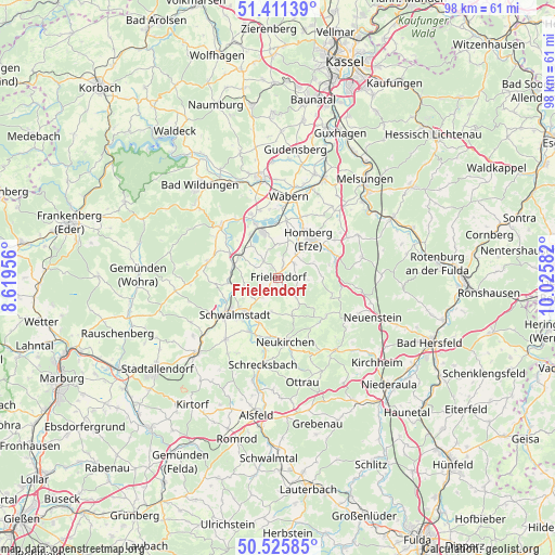
Frielendorf GPS coordinates[2]
50° 58' 14.628" North, 9° 19' 21.684" East
| Map corner | latitude | longitude |
|---|---|---|
| Upper-left | 51.41139°, | 8.61956° |
| Center: | 50.97073°, | 9.32269° |
| Lower-right: | 50.52585°, | 10.02582° |
| Map W x H: | 98.5×98.5 km | = 61.2×61.2mi |
| max Lat: | 55.01917° ⇑42.4% North |
| Frielendorf: | 50.97073° |
| min Lat: | ⇓57.6% South 47.40724° |
| min Long | Frielendorf | max Long |
| 5.92978° | 9.32269° | 14.98853° |
| W 39.6%⇐ | ⇒60.4% E |
Elevation
Elevation of Frielendorf is 233 m = 764 ft, and this is 16.1 m = 53 ft below average elevation for this country.
| Max E: |
1256 m = 4121 ft | 49% |
| Avg. | 249.1 m = 817 ft | |
| Frielendorf | 233 m = 764 ft | |
Min E: |
-5 m = -16 ft | 51% |
See also: Germany elevation on elevation.city.
Geographical zone
Frielendorf is located in North temperate zone (between Tropic of Cancer and the Arctic Circle). Distance of this North polar circle is 1733.8 km =1077.3 mi to North.| Distance of | km | miles | from Frielendorf |
|---|---|---|---|
| North Pole | 4339.6 | 2696.5 | to North |
| Arctic Circle | 1733.8 | 1077.3 | to North |
| Tropic Cancer | 3061.5 | 1902.3 | to South |
| Equator | 5667.4 | 3521.6 | to South |


Nearby cities:
15 places around Frielendorf: (largest is in red/bold)
• Borken
8.7 km =5.4 mi,  342°
342°
• Fritzlar
18.2 km =11.3 mi,  349°
349°
• Gilserberg
18.1 km =11.2 mi,  262°
262°
• Homberg
8.6 km =5.3 mi,  40°
40°
• Jesberg
12.5 km =7.8 mi,  285°
285°
• Neuental
8.1 km =5 mi, 293°
• Neukirchen
11.4 km =7.1 mi,  171°
171°
• Oberaula
16.8 km =10.4 mi,  143°
143°
• Riebelsdorf
10.3 km =6.4 mi,  185°
185°
• Schrecksbach
15.5 km =9.6 mi, 190°
• Schwalmstadt
8.5 km =5.3 mi,  240°
240°
• Schwarzenborn
11 km =6.8 mi,  127°
127°
• Seigertshausen
7.1 km =4.4 mi,  159°
159°
• Wabern
14.5 km =9 mi,  7°
7°
• Willingshausen
15.9 km =9.9 mi,  212°
212°
Sources, notices
• [Note1] Compared only with cities in Germany existing in our database
• [Src1] Map data: © OpenStreetMap contributors (CC-BY-SA)
• [Src2] Other city data from geonames.org with taken over terms of usage.
• [Src3] Geographical zone / Annual Mean Temperature by Robert A. Rohde @ Wikipedia
