Empfingen geodata
Empfingen (Baden-Württemberg) is a seat of a fourth-order administrative division; located in Germany in Europe/Berlin (GMT+2) time zone. With population of 4,123 people, there are 3210 cities with bigger population in this country. Compared to other cities in Germany, 90.3% of cities are located further ↑North; 68.9% of cities are located further →East and 87.9% of cities have lower elevation than Empfingen. Note1
Administrative division(s):
- Level 1: Baden-Württemberg
- Level 2: Karlsruhe Region
- Level 3: Landkreis Freudenstadt
- Level 4: Empfingen


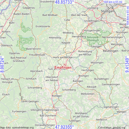
Empfingen GPS coordinates[2]
48° 23' 33.288" North, 8° 42' 37.296" East
| Map corner | latitude | longitude |
|---|---|---|
| Upper-left | 48.85733°, | 8.00724° |
| Center: | 48.39258°, | 8.71036° |
| Lower-right: | 47.92355°, | 9.41349° |
| Map W x H: | 103.8×103.8 km | = 64.5×64.5mi |
| max Lat: | 55.01917° ⇑90.3% North |
| Empfingen: | 48.39258° |
| min Lat: | ⇓9.7% South 47.40724° |
| min Long | Empfingen | max Long |
| 5.92978° | 8.71036° | 14.98853° |
| W 31.1%⇐ | ⇒68.9% E |
Elevation
Elevation of Empfingen is 493 m = 1617 ft, and this is 243.9 m = 800 ft above average elevation for this country.
| Max E: |
1256 m = 4121 ft | 12.1% |
| Empfingen | 493 m 1617 ft | |
| Avg. | 249.1 m = 817 ft | |
Min E: |
-5 m = -16 ft | 87.9% |
See also: Germany elevation on elevation.city.
Geographical zone
Empfingen is located in North temperate zone (between Tropic of Cancer and the Arctic Circle). Distance of this North polar circle is 2020.4 km =1255.4 mi to North.| Distance of | km | miles | from Empfingen |
|---|---|---|---|
| North Pole | 4626.3 | 2874.6 | to North |
| Arctic Circle | 2020.4 | 1255.4 | to North |
| Tropic Cancer | 2774.8 | 1724.2 | to South |
| Equator | 5380.8 | 3343.5 | to South |


Nearby cities:
15 places around Empfingen: (largest is in red/bold)
• Dornhan
15.6 km =9.7 mi,  252°
252°
• Geislingen
13.9 km =8.6 mi,  147°
147°
• Glatten
15.7 km =9.8 mi,  290°
290°
• Grosselfingen
14.7 km =9.1 mi,  117°
117°
• Haigerloch
7.5 km =4.7 mi,  113°
113°
• Haiterbach
15.1 km =9.4 mi,  341°
341°
• Hirrlingen
13.3 km =8.3 mi,  80°
80°
• Horb am Neckar
5.9 km =3.7 mi,  346°
346°
• Mühlheim am Bach
1.8 km =1.1 mi,  211°
211°
• Oberndorf
15.3 km =9.5 mi,  221°
221°
• Rangendingen
13.3 km =8.3 mi,  95°
95°
• Rosenfeld
11.8 km =7.3 mi,  175°
175°
• Schopfloch
13.6 km =8.5 mi,  300°
300°
• Sulz am Neckar
6.6 km =4.1 mi,  239°
239°
• Vöhringen
7.3 km =4.5 mi, 207°
Sources, notices
• [Note1] Compared only with cities in Germany existing in our database
• [Src1] Map data: © OpenStreetMap contributors (CC-BY-SA)
• [Src2] Other city data from geonames.org with taken over terms of usage.
• [Src3] Geographical zone / Annual Mean Temperature by Robert A. Rohde @ Wikipedia
