Tautenhain geodata
Tautenhain (Thuringia) is a seat of a fourth-order administrative division; located in Germany in Europe/Berlin (GMT+2) time zone. With population of 1,273 people, there are 6386 cities with bigger population in this country. Compared to other cities in Germany, 56.7% of cities are located further ↓South; 80.6% of cities are located further ←West and 68.4% of cities have lower elevation than Tautenhain. Note1


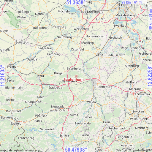
Tautenhain GPS coordinates[2]
50° 55' 28.92" North, 11° 55' 10.02" East
| Map corner | latitude | longitude |
|---|---|---|
| Upper-left | 51.3658°, | 11.21633° |
| Center: | 50.9247°, | 11.91945° |
| Lower-right: | 50.47938°, | 12.62258° |
| Map W x H: | 98.6×98.6 km | = 61.3×61.3mi |
| max Lat: | 55.01917° ⇑43.3% North |
| Tautenhain: | 50.9247° |
| min Lat: | ⇓56.7% South 47.40724° |
| min Long | Tautenhain | max Long |
| 5.92978° | 11.91945° | 14.98853° |
| W 80.6%⇐ | ⇒19.4% E |
Elevation
Elevation of Tautenhain is 346 m = 1135 ft, and this is 96.9 m = 318 ft above average elevation for this country.
| Max E: |
1256 m = 4121 ft | 31.6% |
| Tautenhain | 346 m 1135 ft | |
| Avg. | 249.1 m = 817 ft | |
Min E: |
-5 m = -16 ft | 68.4% |
See also: Germany elevation on elevation.city.
Geographical zone
Tautenhain is located in North temperate zone (between Tropic of Cancer and the Arctic Circle). Distance of this North polar circle is 1738.9 km =1080.5 mi to North.| Distance of | km | miles | from Tautenhain |
|---|---|---|---|
| North Pole | 4344.8 | 2699.7 | to North |
| Arctic Circle | 1738.9 | 1080.5 | to North |
| Tropic Cancer | 3056.4 | 1899.2 | to South |
| Equator | 5662.3 | 3518.4 | to South |


Nearby cities:
15 places around Tautenhain: (largest is in red/bold)
• Bad Klosterlausnitz
3.8 km =2.4 mi,  256°
256°
• Bad Köstritz
6.4 km =4 mi,  84°
84°
• Caaschwitz
6.3 km =3.9 mi,  63°
63°
• Eisenberg
5 km =3.1 mi,  345°
345°
• Hainspitz
7 km =4.3 mi,  305°
305°
• Hartmannsdorf
5.6 km =3.5 mi,  44°
44°
• Hartmannsdorf
6.3 km =3.9 mi,  115°
115°
• Hermsdorf
5.4 km =3.4 mi,  235°
235°
• Kraftsdorf
5.5 km =3.4 mi,  172°
172°
• Rauda
3.5 km =2.2 mi,  27°
27°
• Reichenbach
6.9 km =4.3 mi,  204°
204°
• Sankt Gangloff
7.9 km =4.9 mi,  192°
192°
• Serba
7.7 km =4.8 mi,  291°
291°
• Silbitz
6.3 km =3.9 mi, 63°
• Weißenborn
2.8 km =1.7 mi,  268°
268°
Sources, notices
• [Note1] Compared only with cities in Germany existing in our database
• [Src1] Map data: © OpenStreetMap contributors (CC-BY-SA)
• [Src2] Other city data from geonames.org with taken over terms of usage.
• [Src3] Geographical zone / Annual Mean Temperature by Robert A. Rohde @ Wikipedia
