Tacherting geodata
Tacherting (Bavaria) is a seat of a fourth-order administrative division; located in Germany in Europe/Berlin (GMT+2) time zone. With population of 5,704 people, there are 2562 cities with bigger population in this country. Compared to other cities in Germany, 94.3% of cities are located further ↑North; 88.6% of cities are located further ←West and 85.8% of cities have lower elevation than Tacherting. Note1
Administrative division(s):
- Level 1: Bavaria
- Level 2: Upper Bavaria
- Level 3: Landkreis Traunstein
- Level 4: Tacherting


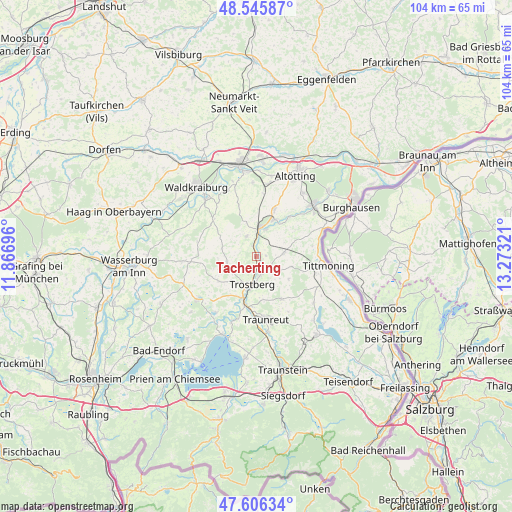
Tacherting GPS coordinates[2]
48° 4' 41.7" North, 12° 34' 12.288" East
| Map corner | latitude | longitude |
|---|---|---|
| Upper-left | 48.54587°, | 11.86696° |
| Center: | 48.07825°, | 12.57008° |
| Lower-right: | 47.60634°, | 13.27321° |
| Map W x H: | 104.5×104.5 km | = 64.9×64.9mi |
| max Lat: | 55.01917° ⇑94.3% North |
| Tacherting: | 48.07825° |
| min Lat: | ⇓5.7% South 47.40724° |
| min Long | Tacherting | max Long |
| 5.92978° | 12.57008° | 14.98853° |
| W 88.6%⇐ | ⇒11.4% E |
Elevation
Elevation of Tacherting is 475 m = 1558 ft, and this is 225.9 m = 741 ft above average elevation for this country.
| Max E: |
1256 m = 4121 ft | 14.2% |
| Tacherting | 475 m 1558 ft | |
| Avg. | 249.1 m = 817 ft | |
Min E: |
-5 m = -16 ft | 85.8% |
See also: Germany elevation on elevation.city.
Geographical zone
Tacherting is located in North temperate zone (between Tropic of Cancer and the Arctic Circle). Distance of this North polar circle is 2055.4 km =1277.2 mi to North.| Distance of | km | miles | from Tacherting |
|---|---|---|---|
| North Pole | 4661.3 | 2896.4 | to North |
| Arctic Circle | 2055.4 | 1277.2 | to North |
| Tropic Cancer | 2739.9 | 1702.5 | to South |
| Equator | 5345.8 | 3321.7 | to South |


Nearby cities:
15 places around Tacherting: (largest is in red/bold)
• Engelsberg
4.7 km =2.9 mi,  334°
334°
• Garching an der Alz
6.3 km =3.9 mi,  7°
7°
• Halsbach
10.4 km =6.5 mi,  53°
53°
• Kienberg
9.3 km =5.8 mi,  238°
238°
• Kirchweidach
5.6 km =3.5 mi,  81°
81°
• Oberneukirchen
12.3 km =7.6 mi,  341°
341°
• Obing
15 km =9.3 mi,  234°
234°
• Palling
9.8 km =6.1 mi,  149°
149°
• Seeon-Seebruck
14.6 km =9.1 mi,  211°
211°
• Taufkirchen
12 km =7.5 mi,  311°
311°
• Tittmoning
14.8 km =9.2 mi,  97°
97°
• Traunreut
13 km =8.1 mi,  172°
172°
• Trostberg an der Alz
5.7 km =3.5 mi,  189°
189°
• Tyrlaching
7.3 km =4.5 mi, 100°
• Unterneukirchen
10.4 km =6.5 mi,  19°
19°
Sources, notices
• [Note1] Compared only with cities in Germany existing in our database
• [Src1] Map data: © OpenStreetMap contributors (CC-BY-SA)
• [Src2] Other city data from geonames.org with taken over terms of usage.
• [Src3] Geographical zone / Annual Mean Temperature by Robert A. Rohde @ Wikipedia
