Halsbach geodata
Halsbach (Bavaria) is a seat of a fourth-order administrative division; located in Germany in Europe/Berlin (GMT+2) time zone. With population of 830 people, there are 7773 cities with bigger population in this country. Compared to other cities in Germany, 93.6% of cities are located further ↑North; 89.6% of cities are located further ←West and 86.9% of cities have lower elevation than Halsbach. Note1
Administrative division(s):
- Level 1: Bavaria
- Level 2: Upper Bavaria
- Level 3: Landkreis Altötting
- Level 4: Halsbach


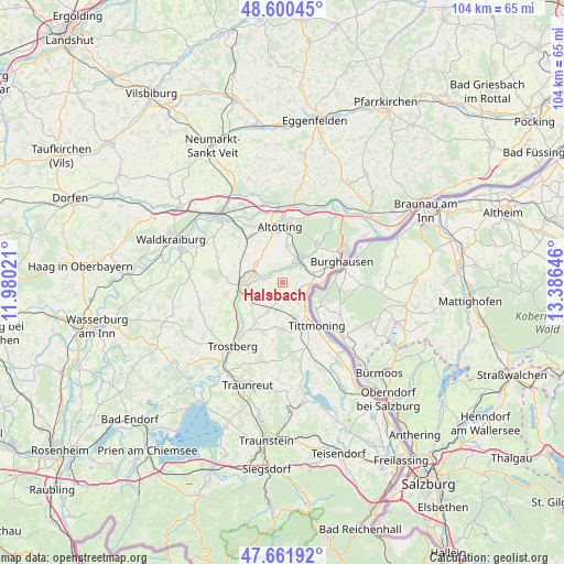
Halsbach GPS coordinates[2]
48° 7' 59.988" North, 12° 40' 59.988" East
| Map corner | latitude | longitude |
|---|---|---|
| Upper-left | 48.60045°, | 11.98021° |
| Center: | 48.13333°, | 12.68333° |
| Lower-right: | 47.66192°, | 13.38646° |
| Map W x H: | 104.4×104.4 km | = 64.9×64.9mi |
| max Lat: | 55.01917° ⇑93.6% North |
| Halsbach: | 48.13333° |
| min Lat: | ⇓6.4% South 47.40724° |
| min Long | Halsbach | max Long |
| 5.92978° | 12.68333° | 14.98853° |
| W 89.6%⇐ | ⇒10.4% E |
Elevation
Elevation of Halsbach is 485 m = 1591 ft, and this is 235.9 m = 774 ft above average elevation for this country.
| Max E: |
1256 m = 4121 ft | 13.1% |
| Halsbach | 485 m 1591 ft | |
| Avg. | 249.1 m = 817 ft | |
Min E: |
-5 m = -16 ft | 86.9% |
See also: Germany elevation on elevation.city.
Geographical zone
Halsbach is located in North temperate zone (between Tropic of Cancer and the Arctic Circle). Distance of this North polar circle is 2049.2 km =1273.3 mi to North.| Distance of | km | miles | from Halsbach |
|---|---|---|---|
| North Pole | 4655.1 | 2892.5 | to North |
| Arctic Circle | 2049.2 | 1273.3 | to North |
| Tropic Cancer | 2746 | 1706.3 | to South |
| Equator | 5351.9 | 3325.5 | to South |


Nearby cities:
15 places around Halsbach: (largest is in red/bold)
• Altötting
10.2 km =6.3 mi,  357°
357°
• Burghausen
11.7 km =7.3 mi,  70°
70°
• Burgkirchen an der Alz
5.3 km =3.3 mi,  43°
43°
• Engelsberg
10.6 km =6.6 mi,  259°
259°
• Garching an der Alz
7.6 km =4.7 mi,  270°
270°
• Kastl
7.5 km =4.7 mi,  9°
9°
• Kirchweidach
6 km =3.7 mi,  208°
208°
• Mehring
9.3 km =5.8 mi,  53°
53°
• Neuötting
12 km =7.5 mi,  2°
2°
• Tacherting
10.4 km =6.5 mi,  233°
233°
• Teising
11.7 km =7.3 mi,  332°
332°
• Tittmoning
10.1 km =6.3 mi,  141°
141°
• Tyrlaching
7.5 km =4.7 mi,  189°
189°
• Tüßling
10.7 km =6.6 mi,  324°
324°
• Unterneukirchen
6.2 km =3.9 mi,  306°
306°
Sources, notices
• [Note1] Compared only with cities in Germany existing in our database
• [Src1] Map data: © OpenStreetMap contributors (CC-BY-SA)
• [Src2] Other city data from geonames.org with taken over terms of usage.
• [Src3] Geographical zone / Annual Mean Temperature by Robert A. Rohde @ Wikipedia
