Stützerbach geodata
Stützerbach (Thuringia) is a seat of a fourth-order administrative division; located in Germany in Europe/Berlin (GMT+2) time zone. With population of 1,698 people, there are 5515 cities with bigger population in this country. Compared to other cities in Germany, 50.3% of cities are located further ↓South; 65% of cities are located further ←West and 96.9% of cities have lower elevation than Stützerbach. Note1


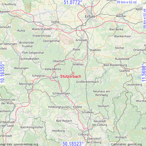
Stützerbach GPS coordinates[2]
50° 37' 59.988" North, 10° 52' 0.012" East
| Map corner | latitude | longitude |
|---|---|---|
| Upper-left | 51.0772°, | 10.16355° |
| Center: | 50.63333°, | 10.86667° |
| Lower-right: | 50.18523°, | 11.5698° |
| Map W x H: | 99.2×99.2 km | = 61.6×61.6mi |
| max Lat: | 55.01917° ⇑49.7% North |
| Stützerbach: | 50.63333° |
| min Lat: | ⇓50.3% South 47.40724° |
| min Long | Stützerbach | max Long |
| 5.92978° | 10.86667° | 14.98853° |
| W 65%⇐ | ⇒35% E |
Elevation
Elevation of Stützerbach is 660 m = 2165 ft, and this is 410.9 m = 1348 ft above average elevation for this country.
| Max E: |
1256 m = 4121 ft | 3.1% |
| Stützerbach | 660 m 2165 ft | |
| Avg. | 249.1 m = 817 ft | |
Min E: |
-5 m = -16 ft | 96.9% |
See also: Germany elevation on elevation.city.
Geographical zone
Stützerbach is located in North temperate zone (between Tropic of Cancer and the Arctic Circle). Distance of this North polar circle is 1771.3 km =1100.6 mi to North.| Distance of | km | miles | from Stützerbach |
|---|---|---|---|
| North Pole | 4377.2 | 2719.9 | to North |
| Arctic Circle | 1771.3 | 1100.6 | to North |
| Tropic Cancer | 3024 | 1879 | to South |
| Equator | 5629.9 | 3498.3 | to South |


Nearby cities:
15 places around Stützerbach: (largest is in red/bold)
• Altenfeld
10.2 km =6.3 mi,  136°
136°
• Elgersburg
8.1 km =5 mi,  353°
353°
• Frauenwald
5.5 km =3.4 mi,  186°
186°
• Gehlberg
7.3 km =4.5 mi,  313°
313°
• Gehren
9.9 km =6.2 mi,  80°
80°
• Geraberg
9.4 km =5.8 mi, 347°
• Geschwenda
11.3 km =7 mi, 345°
• Gillersdorf
10.7 km =6.6 mi,  99°
99°
• Ilmenau
6.6 km =4.1 mi,  33°
33°
• Langewiesen
8.6 km =5.3 mi,  59°
59°
• Martinroda
10.1 km =6.3 mi,  8°
8°
• Möhrenbach
9.2 km =5.7 mi, 96°
• Neuhaus
7.3 km =4.5 mi,  40°
40°
• Neustadt am Rennsteig
7.3 km =4.5 mi, 139°
• Schmiedefeld am Rennsteig
4.7 km =2.9 mi,  234°
234°
Sources, notices
• [Note1] Compared only with cities in Germany existing in our database
• [Src1] Map data: © OpenStreetMap contributors (CC-BY-SA)
• [Src2] Other city data from geonames.org with taken over terms of usage.
• [Src3] Geographical zone / Annual Mean Temperature by Robert A. Rohde @ Wikipedia
