Frauenwald geodata
Frauenwald (Thuringia) is a seat of a fourth-order administrative division; located in Germany in Europe/Berlin (GMT+2) time zone. With population of 1,131 people, there are 6759 cities with bigger population in this country. Compared to other cities in Germany, 50.8% of cities are located further ↑North; 64.9% of cities are located further ←West and 98.7% of cities have lower elevation than Frauenwald. Note1


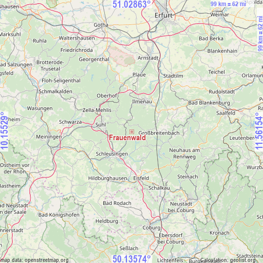
Frauenwald GPS coordinates[2]
50° 35' 3.48" North, 10° 51' 30.276" East
| Map corner | latitude | longitude |
|---|---|---|
| Upper-left | 51.02863°, | 10.15529° |
| Center: | 50.5843°, | 10.85841° |
| Lower-right: | 50.13574°, | 11.56154° |
| Map W x H: | 99.3×99.3 km | = 61.7×61.7mi |
| max Lat: | 55.01917° ⇑50.8% North |
| Frauenwald: | 50.5843° |
| min Lat: | ⇓49.2% South 47.40724° |
| min Long | Frauenwald | max Long |
| 5.92978° | 10.85841° | 14.98853° |
| W 64.9%⇐ | ⇒35.1% E |
Elevation
Elevation of Frauenwald is 752 m = 2467 ft, and this is 502.9 m = 1650 ft above average elevation for this country.
| Max E: |
1256 m = 4121 ft | 1.3% |
| Frauenwald | 752 m 2467 ft | |
| Avg. | 249.1 m = 817 ft | |
Min E: |
-5 m = -16 ft | 98.7% |
See also: Germany elevation on elevation.city.
Geographical zone
Frauenwald is located in North temperate zone (between Tropic of Cancer and the Arctic Circle). Distance of this North polar circle is 1776.7 km =1104 mi to North.| Distance of | km | miles | from Frauenwald |
|---|---|---|---|
| North Pole | 4382.6 | 2723.2 | to North |
| Arctic Circle | 1776.7 | 1104 | to North |
| Tropic Cancer | 3018.5 | 1875.6 | to South |
| Equator | 5624.4 | 3494.8 | to South |


Nearby cities:
15 places around Frauenwald: (largest is in red/bold)
• Altenfeld
7.9 km =4.9 mi,  104°
104°
• Gehlberg
11.5 km =7.1 mi,  335°
335°
• Gillersdorf
11.7 km =7.3 mi,  72°
72°
• Goldisthal
12.5 km =7.8 mi,  126°
126°
• Großbreitenbach
10.7 km =6.6 mi,  90°
90°
• Ilmenau
11.8 km =7.3 mi,  21°
21°
• Masserberg
10.7 km =6.6 mi, 132°
• Möhrenbach
10.6 km =6.6 mi, 65°
• Neuhaus
12.2 km =7.6 mi,  25°
25°
• Neustadt am Rennsteig
5.3 km =3.3 mi, 91°
• Sankt Kilian
9.2 km =5.7 mi,  226°
226°
• Schleusingen
10.9 km =6.8 mi,  221°
221°
• Schmiedefeld am Rennsteig
4.2 km =2.6 mi,  310°
310°
• Stützerbach
5.5 km =3.4 mi,  6°
6°
• Suhl
11.9 km =7.4 mi,  283°
283°
Sources, notices
• [Note1] Compared only with cities in Germany existing in our database
• [Src1] Map data: © OpenStreetMap contributors (CC-BY-SA)
• [Src2] Other city data from geonames.org with taken over terms of usage.
• [Src3] Geographical zone / Annual Mean Temperature by Robert A. Rohde @ Wikipedia
