Staufenberg geodata
Staufenberg (Hesse) is a populated place; located in Germany in Europe/Berlin (GMT+2) time zone. With population of 8,346 people, there are 1896 cities with bigger population in this country. Compared to other cities in Germany, 51% of cities are located further ↓South; 68.8% of cities are located further →East and 52.3% of cities have higher elevation than Staufenberg. Note1
Administrative division(s):
- Level 1: Hesse
- Level 2: Regierungsbezirk Gießen
- Level 3: Landkreis Gießen
- Level 4: Staufenberg


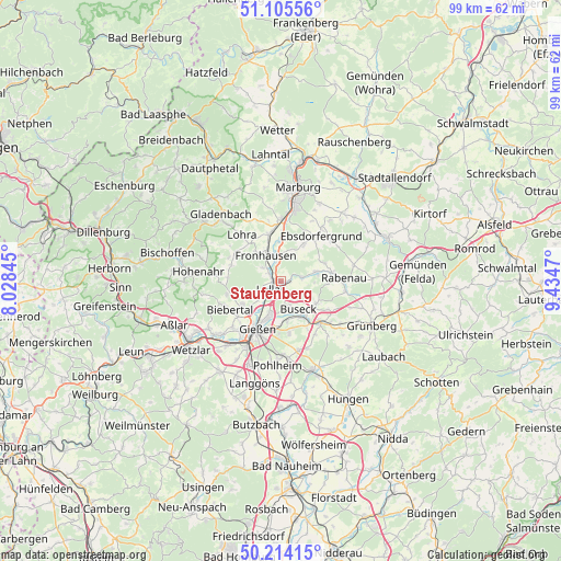
Staufenberg GPS coordinates[2]
50° 39' 43.092" North, 8° 43' 53.688" East
| Map corner | latitude | longitude |
|---|---|---|
| Upper-left | 51.10556°, | 8.02845° |
| Center: | 50.66197°, | 8.73158° |
| Lower-right: | 50.21415°, | 9.4347° |
| Map W x H: | 99.1×99.1 km | = 61.6×61.6mi |
| max Lat: | 55.01917° ⇑49% North |
| Staufenberg: | 50.66197° |
| min Lat: | ⇓51% South 47.40724° |
| min Long | Staufenberg | max Long |
| 5.92978° | 8.73158° | 14.98853° |
| W 31.2%⇐ | ⇒68.8% E |
Elevation
Elevation of Staufenberg is 209 m = 686 ft, and this is 40.1 m = 132 ft below average elevation for this country.
| Max E: |
1256 m = 4121 ft | 52.3% |
| Avg. | 249.1 m = 817 ft | |
| Staufenberg | 209 m = 686 ft | |
Min E: |
-5 m = -16 ft | 47.7% |
See also: Germany elevation on elevation.city.
Geographical zone
Staufenberg is located in North temperate zone (between Tropic of Cancer and the Arctic Circle). Distance of this North polar circle is 1768.1 km =1098.6 mi to North.| Distance of | km | miles | from Staufenberg |
|---|---|---|---|
| North Pole | 4374 | 2717.9 | to North |
| Arctic Circle | 1768.1 | 1098.6 | to North |
| Tropic Cancer | 3027.2 | 1881 | to South |
| Equator | 5633.1 | 3500.2 | to South |


Nearby cities:
15 places around Staufenberg: (largest is in red/bold)
• Allendorf an der Lahn
14.6 km =9.1 mi,  212°
212°
• Alten Buseck
4.7 km =2.9 mi,  160°
160°
• Beuern
7.4 km =4.6 mi,  121°
121°
• Ebsdorfergrund
11.3 km =7 mi,  51°
51°
• Fronhausen
4.8 km =3 mi,  332°
332°
• Gießen
9.2 km =5.7 mi, 205°
• Gladenbach
15.9 km =9.9 mi,  318°
318°
• Großen Buseck
7.4 km =4.6 mi,  148°
148°
• Heuchelheim
11.2 km =7 mi,  218°
218°
• Höingen
14.7 km =9.1 mi,  64°
64°
• Lohra
10.5 km =6.5 mi, 318°
• Lollar
2.5 km =1.6 mi,  227°
227°
• Rabenau
9.5 km =5.9 mi,  79°
79°
• Reiskirchen
9.9 km =6.2 mi,  133°
133°
• Trohe
6 km =3.7 mi,  165°
165°
Sources, notices
• [Note1] Compared only with cities in Germany existing in our database
• [Src1] Map data: © OpenStreetMap contributors (CC-BY-SA)
• [Src2] Other city data from geonames.org with taken over terms of usage.
• [Src3] Geographical zone / Annual Mean Temperature by Robert A. Rohde @ Wikipedia
