Gießen geodata
Gießen (Hesse) is a seat of a second-order administrative division; located in Germany in Europe/Berlin (GMT+2) time zone. With population of 74,411 people, there are 141 cities with bigger population in this country. Compared to other cities in Germany, 50.8% of cities are located further ↑North; 69.3% of cities are located further →East and 58.8% of cities have higher elevation than Gießen. Note1
Administrative division(s):
- Level 1: Hesse
- Level 2: Regierungsbezirk Gießen
- Level 3: Landkreis Gießen
- Level 4: Gießen, Universitätsstadt


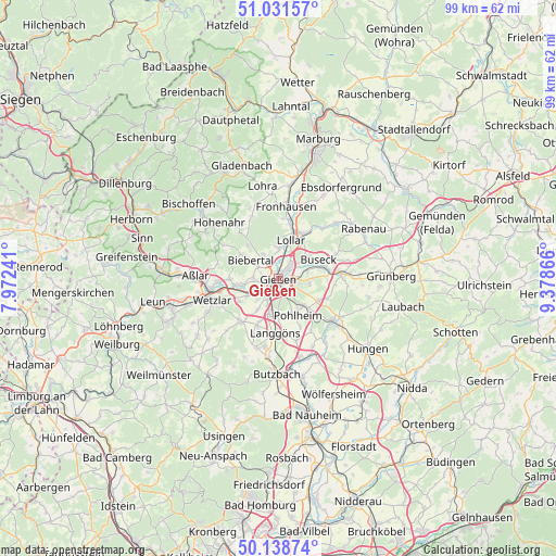
Gießen GPS coordinates[2]
50° 35' 14.172" North, 8° 40' 31.944" East
| Map corner | latitude | longitude |
|---|---|---|
| Upper-left | 51.03157°, | 7.97241° |
| Center: | 50.58727°, | 8.67554° |
| Lower-right: | 50.13874°, | 9.37866° |
| Map W x H: | 99.3×99.3 km | = 61.7×61.7mi |
| max Lat: | 55.01917° ⇑50.8% North |
| Gießen: | 50.58727° |
| min Lat: | ⇓49.2% South 47.40724° |
| min Long | Gießen | max Long |
| 5.92978° | 8.67554° | 14.98853° |
| W 30.7%⇐ | ⇒69.3% E |
Elevation
Elevation of Gießen is 162 m = 531 ft, and this is 87.1 m = 286 ft below average elevation for this country.
| Max E: |
1256 m = 4121 ft | 58.8% |
| Avg. | 249.1 m = 817 ft | |
| Gießen | 162 m = 531 ft | |
Min E: |
-5 m = -16 ft | 41.2% |
See also: Gießen elevation on elevation.city.
Geographical zone
Gießen is located in North temperate zone (between Tropic of Cancer and the Arctic Circle). Distance of this North polar circle is 1776.4 km =1103.8 mi to North.| Distance of | km | miles | from Gießen |
|---|---|---|---|
| North Pole | 4382.3 | 2723 | to North |
| Arctic Circle | 1776.4 | 1103.8 | to North |
| Tropic Cancer | 3018.9 | 1875.9 | to South |
| Equator | 5624.8 | 3495.1 | to South |


Nearby cities:
15 places around Gießen: (largest is in red/bold)
• Allendorf an der Lahn
5.6 km =3.5 mi,  224°
224°
• Alten Buseck
6.7 km =4.2 mi,  54°
54°
• Aßlar
15 km =9.3 mi,  271°
271°
• Beuern
11.2 km =7 mi,  66°
66°
• Fronhausen
12.7 km =7.9 mi,  7°
7°
• Großen Buseck
8 km =5 mi,  75°
75°
• Heuchelheim
3 km =1.9 mi,  261°
261°
• Hörnsheim
8.3 km =5.2 mi,  202°
202°
• Langgöns
9.7 km =6 mi,  183°
183°
• Lich
12.4 km =7.7 mi,  126°
126°
• Lollar
6.9 km =4.3 mi,  17°
17°
• Reiskirchen
11.2 km =7 mi, 82°
• Staufenberg
9.2 km =5.7 mi,  25°
25°
• Trohe
6 km =3.7 mi, 65°
• Wetzlar
12.4 km =7.7 mi, 256°
Sources, notices
• [Note1] Compared only with cities in Germany existing in our database
• [Src1] Map data: © OpenStreetMap contributors (CC-BY-SA)
• [Src2] Other city data from geonames.org with taken over terms of usage.
• [Src3] Geographical zone / Annual Mean Temperature by Robert A. Rohde @ Wikipedia
