Bonndorf geodata
Bonndorf (Baden-Württemberg) is a populated place; located in Germany in Europe/Berlin (GMT+2) time zone. With population of 6,875 people, there are 2208 cities with bigger population in this country. Compared to other cities in Germany, 97.4% of cities are located further ↑North; 72.5% of cities are located further →East and 99.5% of cities have lower elevation than Bonndorf. Note1
Administrative division(s):
- Level 1: Baden-Württemberg
- Level 2: Freiburg Region
- Level 3: Landkreis Waldshut
- Level 4: Bonndorf im Schwarzwald


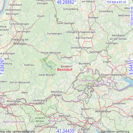
Bonndorf GPS coordinates[2]
47° 49' 7.068" North, 8° 20' 29.004" East
| Map corner | latitude | longitude |
|---|---|---|
| Upper-left | 48.28862°, | 7.63826° |
| Center: | 47.81863°, | 8.34139° |
| Lower-right: | 47.34435°, | 9.04451° |
| Map W x H: | 105×105 km | = 65.2×65.2mi |
| max Lat: | 55.01917° ⇑97.4% North |
| Bonndorf: | 47.81863° |
| min Lat: | ⇓2.6% South 47.40724° |
| min Long | Bonndorf | max Long |
| 5.92978° | 8.34139° | 14.98853° |
| W 27.5%⇐ | ⇒72.5% E |
Elevation
Elevation of Bonndorf is 834 m = 2736 ft, and this is 584.9 m = 1919 ft above average elevation for this country.
| Max E: |
1256 m = 4121 ft | 0.5% |
| Bonndorf | 834 m 2736 ft | |
| Avg. | 249.1 m = 817 ft | |
Min E: |
-5 m = -16 ft | 99.5% |
See also: Germany elevation on elevation.city.
Geographical zone
Bonndorf is located in North temperate zone (between Tropic of Cancer and the Arctic Circle). Distance of this North polar circle is 2084.2 km =1295.1 mi to North.| Distance of | km | miles | from Bonndorf |
|---|---|---|---|
| North Pole | 4690.1 | 2914.3 | to North |
| Arctic Circle | 2084.2 | 1295.1 | to North |
| Tropic Cancer | 2711 | 1684.5 | to South |
| Equator | 5316.9 | 3303.8 | to South |


Nearby cities:
15 places around Bonndorf: (largest is in red/bold)
• Blumberg
14.5 km =9 mi,  80°
80°
• Bräunlingen
14.7 km =9.1 mi,  32°
32°
• Eggingen
13.9 km =8.6 mi,  161°
161°
• Friedenweiler
12.7 km =7.9 mi,  330°
330°
• Grafenhausen
7.9 km =4.9 mi,  232°
232°
• Häusern
15.1 km =9.4 mi,  239°
239°
• Höchenschwand
16.1 km =10 mi, 234°
• Lenzkirch
11.8 km =7.3 mi,  297°
297°
• Löffingen
7.3 km =4.5 mi,  1°
1°
• Reichenbach
15 km =9.3 mi,  324°
324°
• Schluchsee
11.8 km =7.3 mi,  268°
268°
• Staufen
11.9 km =7.4 mi, 234°
• Stühlingen
11.4 km =7.1 mi,  135°
135°
• Titisee-Neustadt
16 km =9.9 mi, 315°
• Ühlingen-Birkendorf
11.5 km =7.1 mi,  189°
189°
Sources, notices
• [Note1] Compared only with cities in Germany existing in our database
• [Src1] Map data: © OpenStreetMap contributors (CC-BY-SA)
• [Src2] Other city data from geonames.org with taken over terms of usage.
• [Src3] Geographical zone / Annual Mean Temperature by Robert A. Rohde @ Wikipedia
