Spraitbach geodata
Spraitbach (Baden-Württemberg) is a seat of a fourth-order administrative division; located in Germany in Europe/Berlin (GMT+2) time zone. With population of 3,550 people, there are 3576 cities with bigger population in this country. Compared to other cities in Germany, 84.3% of cities are located further ↑North; 53.4% of cities are located further →East and 91.8% of cities have lower elevation than Spraitbach. Note1
Administrative division(s):
- Level 1: Baden-Württemberg
- Level 2: Regierungsbezirk Stuttgart
- Level 3: Ostalbkreis
- Level 4: Spraitbach


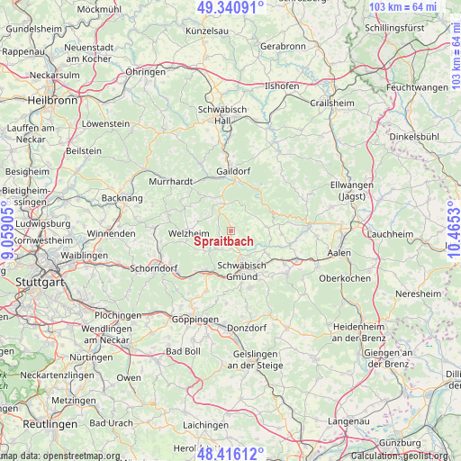
Spraitbach GPS coordinates[2]
48° 52' 50.34" North, 9° 45' 43.812" East
| Map corner | latitude | longitude |
|---|---|---|
| Upper-left | 49.34091°, | 9.05905° |
| Center: | 48.88065°, | 9.76217° |
| Lower-right: | 48.41612°, | 10.4653° |
| Map W x H: | 102.8×102.8 km | = 63.9×63.9mi |
| max Lat: | 55.01917° ⇑84.3% North |
| Spraitbach: | 48.88065° |
| min Lat: | ⇓15.7% South 47.40724° |
| min Long | Spraitbach | max Long |
| 5.92978° | 9.76217° | 14.98853° |
| W 46.6%⇐ | ⇒53.4% E |
Elevation
Elevation of Spraitbach is 540 m = 1772 ft, and this is 290.9 m = 954 ft above average elevation for this country.
| Max E: |
1256 m = 4121 ft | 8.2% |
| Spraitbach | 540 m 1772 ft | |
| Avg. | 249.1 m = 817 ft | |
Min E: |
-5 m = -16 ft | 91.8% |
See also: Germany elevation on elevation.city.
Geographical zone
Spraitbach is located in North temperate zone (between Tropic of Cancer and the Arctic Circle). Distance of this North polar circle is 1966.2 km =1221.7 mi to North.| Distance of | km | miles | from Spraitbach |
|---|---|---|---|
| North Pole | 4572 | 2840.9 | to North |
| Arctic Circle | 1966.2 | 1221.7 | to North |
| Tropic Cancer | 2829.1 | 1757.9 | to South |
| Equator | 5435 | 3377.2 | to South |


Nearby cities:
15 places around Spraitbach: (largest is in red/bold)
• Alfdorf
5.2 km =3.2 mi,  217°
217°
• Durlangen
3.7 km =2.3 mi,  137°
137°
• Eschach
7.9 km =4.9 mi,  83°
83°
• Gschwend
6 km =3.7 mi,  347°
347°
• Göggingen
9.2 km =5.7 mi,  103°
103°
• Iggingen
10.1 km =6.3 mi,  122°
122°
• Kaisersbach
10.6 km =6.6 mi,  301°
301°
• Leinzell
9.1 km =5.7 mi,  112°
112°
• Lorch
10.5 km =6.5 mi,  209°
209°
• Mutlangen
6.6 km =4.1 mi,  157°
157°
• Obergröningen
10.9 km =6.8 mi, 81°
• Ruppertshofen
3.9 km =2.4 mi,  86°
86°
• Schwäbisch Gmünd
9.4 km =5.8 mi, 163°
• Täferrot
6.5 km =4 mi, 121°
• Welzheim
9.4 km =5.8 mi,  267°
267°
Sources, notices
• [Note1] Compared only with cities in Germany existing in our database
• [Src1] Map data: © OpenStreetMap contributors (CC-BY-SA)
• [Src2] Other city data from geonames.org with taken over terms of usage.
• [Src3] Geographical zone / Annual Mean Temperature by Robert A. Rohde @ Wikipedia
