Alfdorf geodata
Alfdorf (Baden-Württemberg) is a seat of a fourth-order administrative division; located in Germany in Europe/Berlin (GMT+2) time zone. With population of 7,187 people, there are 2147 cities with bigger population in this country. Compared to other cities in Germany, 84.8% of cities are located further ↑North; 54% of cities are located further →East and 87.3% of cities have lower elevation than Alfdorf. Note1
Administrative division(s):
- Level 1: Baden-Württemberg
- Level 2: Regierungsbezirk Stuttgart
- Level 3: Rems-Murr-Kreis
- Level 4: Alfdorf


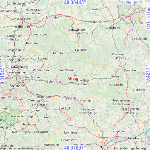
Alfdorf GPS coordinates[2]
48° 50' 37.86" North, 9° 43' 6.852" East
| Map corner | latitude | longitude |
|---|---|---|
| Upper-left | 49.30445°, | 9.01545° |
| Center: | 48.84385°, | 9.71857° |
| Lower-right: | 48.37897°, | 10.4217° |
| Map W x H: | 102.9×102.9 km | = 63.9×63.9mi |
| max Lat: | 55.01917° ⇑84.8% North |
| Alfdorf: | 48.84385° |
| min Lat: | ⇓15.2% South 47.40724° |
| min Long | Alfdorf | max Long |
| 5.92978° | 9.71857° | 14.98853° |
| W 46%⇐ | ⇒54% E |
Elevation
Elevation of Alfdorf is 488 m = 1601 ft, and this is 238.9 m = 784 ft above average elevation for this country.
| Max E: |
1256 m = 4121 ft | 12.7% |
| Alfdorf | 488 m 1601 ft | |
| Avg. | 249.1 m = 817 ft | |
Min E: |
-5 m = -16 ft | 87.3% |
See also: Germany elevation on elevation.city.
Geographical zone
Alfdorf is located in North temperate zone (between Tropic of Cancer and the Arctic Circle). Distance of this North polar circle is 1970.2 km =1224.2 mi to North.| Distance of | km | miles | from Alfdorf |
|---|---|---|---|
| North Pole | 4576.1 | 2843.5 | to North |
| Arctic Circle | 1970.2 | 1224.2 | to North |
| Tropic Cancer | 2825 | 1755.4 | to South |
| Equator | 5430.9 | 3374.6 | to South |


Nearby cities:
15 places around Alfdorf: (largest is in red/bold)
• Birenbach
11.5 km =7.1 mi,  201°
201°
• Durlangen
5.9 km =3.7 mi,  76°
76°
• Gschwend
10.1 km =6.3 mi,  10°
10°
• Kaisersbach
11.2 km =7 mi,  328°
328°
• Lorch
5.4 km =3.4 mi, 201°
• Mutlangen
6.1 km =3.8 mi,  109°
109°
• Plüderhausen
10.3 km =6.4 mi,  240°
240°
• Ruppertshofen
8.3 km =5.2 mi,  58°
58°
• Schwäbisch Gmünd
7.6 km =4.7 mi,  130°
130°
• Spraitbach
5.2 km =3.2 mi,  37°
37°
• Täferrot
8.8 km =5.5 mi,  85°
85°
• Urbach
10.8 km =6.7 mi,  253°
253°
• Waldstetten
11.5 km =7.1 mi,  138°
138°
• Welzheim
7.2 km =4.5 mi,  300°
300°
• Wäschenbeuren
9.6 km =6 mi,  193°
193°
Sources, notices
• [Note1] Compared only with cities in Germany existing in our database
• [Src1] Map data: © OpenStreetMap contributors (CC-BY-SA)
• [Src2] Other city data from geonames.org with taken over terms of usage.
• [Src3] Geographical zone / Annual Mean Temperature by Robert A. Rohde @ Wikipedia
