Leinzell geodata
Leinzell (Baden-Württemberg) is a seat of a fourth-order administrative division; located in Germany in Europe/Berlin (GMT+1) time zone. With population of 2,241 people, there are 4758 cities with bigger population in this country. Compared to other cities in Germany, 84.7% of cities are located further ↑North; 51.8% of cities are located further →East and 75.8% of cities have lower elevation than Leinzell. Note1
Administrative division(s):
- Level 1: Baden-Württemberg
- Level 2: Regierungsbezirk Stuttgart
- Level 3: Ostalbkreis
- Level 4: Leinzell


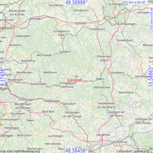
Leinzell GPS coordinates[2]
48° 50' 57.876" North, 9° 52' 39" East
| Map corner | latitude | longitude |
|---|---|---|
| Upper-left | 49.30996°, | 9.17438° |
| Center: | 48.84941°, | 9.8775° |
| Lower-right: | 48.38459°, | 10.58063° |
| Map W x H: | 102.9×102.9 km | = 63.9×63.9mi |
| max Lat: | 55.01917° ⇑84.7% North |
| Leinzell: | 48.84941° |
| min Lat: | ⇓15.3% South 47.40724° |
| min Long | Leinzell | max Long |
| 5.92978° | 9.8775° | 14.98853° |
| W 48.2%⇐ | ⇒51.8% E |
Elevation
Elevation of Leinzell is 404 m = 1325 ft, and this is 154.9 m = 508 ft above average elevation for this country.
| Max E: |
1256 m = 4121 ft | 24.2% |
| Leinzell | 404 m 1325 ft | |
| Avg. | 249.1 m = 817 ft | |
Min E: |
-5 m = -16 ft | 75.8% |
See also: Germany elevation on elevation.city.
Geographical zone
Leinzell is located in North temperate zone (between Tropic of Cancer and the Arctic Circle). Distance of this North polar circle is 1969.6 km =1223.9 mi to North.| Distance of | km | miles | from Leinzell |
|---|---|---|---|
| North Pole | 4575.5 | 2843.1 | to North |
| Arctic Circle | 1969.6 | 1223.9 | to North |
| Tropic Cancer | 2825.6 | 1755.7 | to South |
| Equator | 5431.5 | 3375 | to South |


Nearby cities:
15 places around Leinzell: (largest is in red/bold)
• Böbingen an der Rems
4.6 km =2.9 mi,  136°
136°
• Durlangen
6 km =3.7 mi,  277°
277°
• Eschach
4.4 km =2.7 mi,  352°
352°
• Göggingen
1.4 km =0.9 mi,  19°
19°
• Heubach
7.5 km =4.7 mi,  146°
146°
• Heuchlingen
4.9 km =3 mi,  86°
86°
• Iggingen
2 km =1.2 mi,  176°
176°
• Mutlangen
6.4 km =4 mi,  246°
246°
• Mögglingen
6.9 km =4.3 mi,  115°
115°
• Obergröningen
5.5 km =3.4 mi, 24°
• Ruppertshofen
5.9 km =3.7 mi,  309°
309°
• Schechingen
4 km =2.5 mi,  47°
47°
• Schwäbisch Gmünd
8 km =5 mi,  226°
226°
• Spraitbach
9.1 km =5.7 mi,  292°
292°
• Täferrot
2.9 km =1.8 mi,  270°
270°
Sources, notices
• [Note1] Compared only with cities in Germany existing in our database
• [Src1] Map data: © OpenStreetMap contributors (CC-BY-SA)
• [Src2] Other city data from geonames.org with taken over terms of usage.
• [Src3] Geographical zone / Annual Mean Temperature by Robert A. Rohde @ Wikipedia
