Gschwend geodata
Gschwend (Baden-Württemberg) is a seat of a fourth-order administrative division; located in Germany in Europe/Berlin (GMT+2) time zone. With population of 5,092 people, there are 2794 cities with bigger population in this country. Compared to other cities in Germany, 83.7% of cities are located further ↑North; 53.7% of cities are located further →East and 85.5% of cities have lower elevation than Gschwend. Note1
Administrative division(s):
- Level 1: Baden-Württemberg
- Level 2: Regierungsbezirk Stuttgart
- Level 3: Ostalbkreis
- Level 4: Gschwend


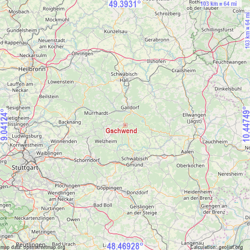
Gschwend GPS coordinates[2]
48° 55' 59.988" North, 9° 44' 39.696" East
| Map corner | latitude | longitude |
|---|---|---|
| Upper-left | 49.3931°, | 9.04124° |
| Center: | 48.93333°, | 9.74436° |
| Lower-right: | 48.46928°, | 10.44749° |
| Map W x H: | 102.7×102.7 km | = 63.8×63.8mi |
| max Lat: | 55.01917° ⇑83.7% North |
| Gschwend: | 48.93333° |
| min Lat: | ⇓16.3% South 47.40724° |
| min Long | Gschwend | max Long |
| 5.92978° | 9.74436° | 14.98853° |
| W 46.3%⇐ | ⇒53.7% E |
Elevation
Elevation of Gschwend is 473 m = 1552 ft, and this is 223.9 m = 735 ft above average elevation for this country.
| Max E: |
1256 m = 4121 ft | 14.5% |
| Gschwend | 473 m 1552 ft | |
| Avg. | 249.1 m = 817 ft | |
Min E: |
-5 m = -16 ft | 85.5% |
See also: Germany elevation on elevation.city.
Geographical zone
Gschwend is located in North temperate zone (between Tropic of Cancer and the Arctic Circle). Distance of this North polar circle is 1960.3 km =1218.1 mi to North.| Distance of | km | miles | from Gschwend |
|---|---|---|---|
| North Pole | 4566.2 | 2837.3 | to North |
| Arctic Circle | 1960.3 | 1218.1 | to North |
| Tropic Cancer | 2835 | 1761.6 | to South |
| Equator | 5440.9 | 3380.8 | to South |


Nearby cities:
15 places around Gschwend: (largest is in red/bold)
• Alfdorf
10.1 km =6.3 mi,  190°
190°
• Althütte
12.9 km =8 mi,  261°
261°
• Durlangen
9.4 km =5.8 mi,  155°
155°
• Eschach
10.5 km =6.5 mi,  118°
118°
• Fichtenberg
6.3 km =3.9 mi,  338°
338°
• Gaildorf
7.7 km =4.8 mi,  13°
13°
• Göggingen
13 km =8.1 mi,  128°
128°
• Kaisersbach
7.7 km =4.8 mi,  267°
267°
• Mutlangen
12.6 km =7.8 mi, 162°
• Obergröningen
12.8 km =8 mi,  109°
109°
• Oberrot
10.6 km =6.6 mi,  328°
328°
• Ruppertshofen
7.6 km =4.7 mi,  137°
137°
• Spraitbach
6 km =3.7 mi,  167°
167°
• Täferrot
11.6 km =7.2 mi, 143°
• Welzheim
10.2 km =6.3 mi,  231°
231°
Sources, notices
• [Note1] Compared only with cities in Germany existing in our database
• [Src1] Map data: © OpenStreetMap contributors (CC-BY-SA)
• [Src2] Other city data from geonames.org with taken over terms of usage.
• [Src3] Geographical zone / Annual Mean Temperature by Robert A. Rohde @ Wikipedia
