Sinn geodata
Sinn (Hesse) is a seat of a fourth-order administrative division; located in Germany in Europe/Berlin (GMT+2) time zone. With population of 6,634 people, there are 2270 cities with bigger population in this country. Compared to other cities in Germany, 50.7% of cities are located further ↓South; 72.6% of cities are located further →East and 51.8% of cities have higher elevation than Sinn. Note1
Administrative division(s):
- Level 1: Hesse
- Level 2: Regierungsbezirk Gießen
- Level 3: Lahn-Dill-Kreis
- Level 4: Sinn


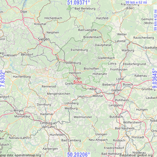
Sinn GPS coordinates[2]
50° 39' 0" North, 8° 19' 59.988" East
| Map corner | latitude | longitude |
|---|---|---|
| Upper-left | 51.09371°, | 7.6302° |
| Center: | 50.65°, | 8.33333° |
| Lower-right: | 50.20206°, | 9.03645° |
| Map W x H: | 99.1×99.1 km | = 61.6×61.6mi |
| max Lat: | 55.01917° ⇑49.3% North |
| Sinn: | 50.65° |
| min Lat: | ⇓50.7% South 47.40724° |
| min Long | Sinn | max Long |
| 5.92978° | 8.33333° | 14.98853° |
| W 27.4%⇐ | ⇒72.6% E |
Elevation
Elevation of Sinn is 213 m = 699 ft, and this is 36.1 m = 118 ft below average elevation for this country.
| Max E: |
1256 m = 4121 ft | 51.8% |
| Avg. | 249.1 m = 817 ft | |
| Sinn | 213 m = 699 ft | |
Min E: |
-5 m = -16 ft | 48.2% |
See also: Germany elevation on elevation.city.
Geographical zone
Sinn is located in North temperate zone (between Tropic of Cancer and the Arctic Circle). Distance of this North polar circle is 1769.4 km =1099.5 mi to North.| Distance of | km | miles | from Sinn |
|---|---|---|---|
| North Pole | 4375.3 | 2718.7 | to North |
| Arctic Circle | 1769.4 | 1099.5 | to North |
| Tropic Cancer | 3025.8 | 1880.1 | to South |
| Equator | 5631.8 | 3499.4 | to South |


Nearby cities:
15 places around Sinn: (largest is in red/bold)
• Aßlar
11.2 km =7 mi,  125°
125°
• Bischoffen
9.9 km =6.2 mi,  55°
55°
• Breitscheid
10.7 km =6.6 mi,  291°
291°
• Burgsolms
13 km =8.1 mi,  157°
157°
• Dillenburg
10.6 km =6.6 mi,  342°
342°
• Driedorf
10.7 km =6.6 mi,  260°
260°
• Ehringshausen
6.6 km =4.1 mi,  147°
147°
• Greifenstein
4.4 km =2.7 mi,  212°
212°
• Herborn
4.1 km =2.5 mi,  329°
329°
• Leun
11.1 km =6.9 mi,  170°
170°
• Merkenbach
2.8 km =1.7 mi,  284°
284°
• Mittenaar
6.6 km =4.1 mi,  32°
32°
• Niederbiel
11.5 km =7.1 mi, 156°
• Oberbiel
12.7 km =7.9 mi, 148°
• Siegbach
11.5 km =7.1 mi, 31°
Sources, notices
• [Note1] Compared only with cities in Germany existing in our database
• [Src1] Map data: © OpenStreetMap contributors (CC-BY-SA)
• [Src2] Other city data from geonames.org with taken over terms of usage.
• [Src3] Geographical zone / Annual Mean Temperature by Robert A. Rohde @ Wikipedia
