Breitscheid geodata
Breitscheid (Hesse) is a seat of a fourth-order administrative division; located in Germany in Europe/Berlin (GMT+2) time zone. With population of 5,000 people, there are 2829 cities with bigger population in this country. Compared to other cities in Germany, 51.7% of cities are located further ↓South; 74.2% of cities are located further →East and 83.1% of cities have lower elevation than Breitscheid. Note1
Administrative division(s):
- Level 1: Hesse
- Level 2: Regierungsbezirk Gießen
- Level 3: Lahn-Dill-Kreis
- Level 4: Breitscheid


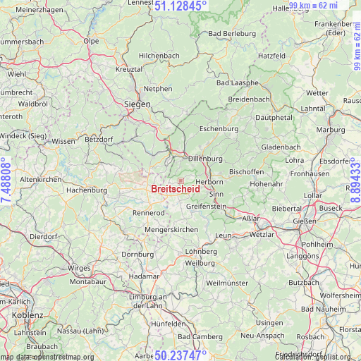
Breitscheid GPS coordinates[2]
50° 41' 6.252" North, 8° 11' 28.32" East
| Map corner | latitude | longitude |
|---|---|---|
| Upper-left | 51.12845°, | 7.48808° |
| Center: | 50.68507°, | 8.1912° |
| Lower-right: | 50.23747°, | 8.89433° |
| Map W x H: | 99.1×99.1 km | = 61.6×61.6mi |
| max Lat: | 55.01917° ⇑48.3% North |
| Breitscheid: | 50.68507° |
| min Lat: | ⇓51.7% South 47.40724° |
| min Long | Breitscheid | max Long |
| 5.92978° | 8.1912° | 14.98853° |
| W 25.8%⇐ | ⇒74.2% E |
Elevation
Elevation of Breitscheid is 454 m = 1490 ft, and this is 204.9 m = 672 ft above average elevation for this country.
| Max E: |
1256 m = 4121 ft | 16.9% |
| Breitscheid | 454 m 1490 ft | |
| Avg. | 249.1 m = 817 ft | |
Min E: |
-5 m = -16 ft | 83.1% |
See also: Germany elevation on elevation.city.
Geographical zone
Breitscheid is located in North temperate zone (between Tropic of Cancer and the Arctic Circle). Distance of this North polar circle is 1765.5 km =1097 mi to North.| Distance of | km | miles | from Breitscheid |
|---|---|---|---|
| North Pole | 4371.4 | 2716.3 | to North |
| Arctic Circle | 1765.5 | 1097 | to North |
| Tropic Cancer | 3029.7 | 1882.6 | to South |
| Equator | 5635.7 | 3501.9 | to South |


Nearby cities:
15 places around Breitscheid: (largest is in red/bold)
• Bretthausen
9 km =5.6 mi,  256°
256°
• Dillenburg
9.2 km =5.7 mi,  47°
47°
• Driedorf
5.8 km =3.6 mi,  185°
185°
• Haiger
6.4 km =4 mi,  10°
10°
• Herborn
7.9 km =4.9 mi,  92°
92°
• Homberg
7.6 km =4.7 mi,  231°
231°
• Liebenscheid
6.7 km =4.2 mi,  281°
281°
• Merkenbach
8 km =5 mi,  113°
113°
• Rehe
7.8 km =4.8 mi,  222°
222°
• Salzburg
10.2 km =6.3 mi, 258°
• Sinn
10.7 km =6.6 mi, 111°
• Stein-Neukirch
9.7 km =6 mi, 264°
• Waigandshain
8.7 km =5.4 mi,  238°
238°
• Willingen
7.5 km =4.7 mi, 255°
• Zehnhausen bei Rennerod
10.2 km =6.3 mi,  245°
245°
Sources, notices
• [Note1] Compared only with cities in Germany existing in our database
• [Src1] Map data: © OpenStreetMap contributors (CC-BY-SA)
• [Src2] Other city data from geonames.org with taken over terms of usage.
• [Src3] Geographical zone / Annual Mean Temperature by Robert A. Rohde @ Wikipedia
