Herborn geodata
Herborn (Hesse) is a populated place; located in Germany in Europe/Berlin (GMT+2) time zone. With population of 21,133 people, there are 722 cities with bigger population in this country. Compared to other cities in Germany, 51.5% of cities are located further ↓South; 72.9% of cities are located further →East and 52.9% of cities have higher elevation than Herborn. Note1
Administrative division(s):
- Level 1: Hesse
- Level 2: Regierungsbezirk Gießen
- Level 3: Lahn-Dill-Kreis
- Level 4: Herborn


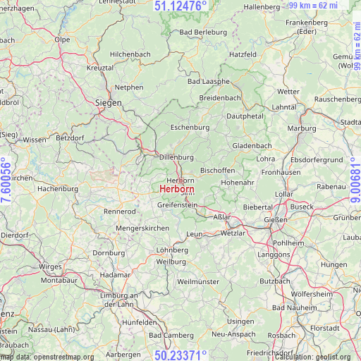
Herborn GPS coordinates[2]
50° 40' 52.86" North, 8° 18' 13.284" East
| Map corner | latitude | longitude |
|---|---|---|
| Upper-left | 51.12476°, | 7.60056° |
| Center: | 50.68135°, | 8.30369° |
| Lower-right: | 50.23371°, | 9.00681° |
| Map W x H: | 99.1×99.1 km | = 61.6×61.6mi |
| max Lat: | 55.01917° ⇑48.5% North |
| Herborn: | 50.68135° |
| min Lat: | ⇓51.5% South 47.40724° |
| min Long | Herborn | max Long |
| 5.92978° | 8.30369° | 14.98853° |
| W 27.1%⇐ | ⇒72.9% E |
Elevation
Elevation of Herborn is 205 m = 673 ft, and this is 44.1 m = 145 ft below average elevation for this country.
| Max E: |
1256 m = 4121 ft | 52.9% |
| Avg. | 249.1 m = 817 ft | |
| Herborn | 205 m = 673 ft | |
Min E: |
-5 m = -16 ft | 47.1% |
See also: Germany elevation on elevation.city.
Geographical zone
Herborn is located in North temperate zone (between Tropic of Cancer and the Arctic Circle). Distance of this North polar circle is 1765.9 km =1097.3 mi to North.| Distance of | km | miles | from Herborn |
|---|---|---|---|
| North Pole | 4371.8 | 2716.5 | to North |
| Arctic Circle | 1765.9 | 1097.3 | to North |
| Tropic Cancer | 3029.3 | 1882.3 | to South |
| Equator | 5635.2 | 3501.5 | to South |


Nearby cities:
15 places around Herborn: (largest is in red/bold)
• Aßlar
15 km =9.3 mi,  131°
131°
• Bischoffen
10.5 km =6.5 mi,  78°
78°
• Breitscheid
7.9 km =4.9 mi,  272°
272°
• Dillenburg
6.8 km =4.2 mi,  349°
349°
• Driedorf
10 km =6.2 mi,  237°
237°
• Ehringshausen
10.6 km =6.6 mi,  148°
148°
• Greifenstein
7.2 km =4.5 mi,  182°
182°
• Haiger
9.5 km =5.9 mi,  314°
314°
• Homberg
14.6 km =9.1 mi,  252°
252°
• Liebenscheid
14.6 km =9.1 mi,  276°
276°
• Merkenbach
2.9 km =1.8 mi,  192°
192°
• Mittenaar
6 km =3.7 mi,  69°
69°
• Rehe
14.2 km =8.8 mi, 247°
• Siegbach
10.3 km =6.4 mi,  51°
51°
• Sinn
4.1 km =2.5 mi, 149°
Sources, notices
• [Note1] Compared only with cities in Germany existing in our database
• [Src1] Map data: © OpenStreetMap contributors (CC-BY-SA)
• [Src2] Other city data from geonames.org with taken over terms of usage.
• [Src3] Geographical zone / Annual Mean Temperature by Robert A. Rohde @ Wikipedia
