Siegen geodata
Siegen (North Rhine-Westphalia) is a seat of a third-order administrative division; located in Germany in Europe/Berlin (GMT+2) time zone. With population of 107,242 people, there are 89 cities with bigger population in this country. Compared to other cities in Germany, 55.6% of cities are located further ↓South; 76.7% of cities are located further →East and 57% of cities have lower elevation than Siegen. Note1
Administrative division(s):
- Level 1: North Rhine-Westphalia
- Level 2: Regierungsbezirk Arnsberg
- Level 3: Kreis Siegen-Wittgenstein
- Level 4: Siegen


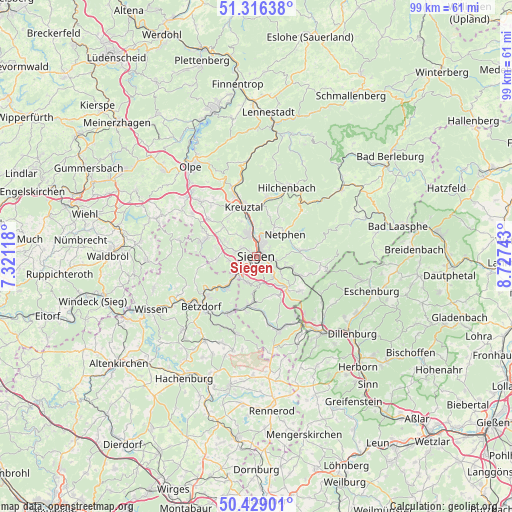
Siegen GPS coordinates[2]
50° 52' 29.316" North, 8° 1' 27.516" East
| Map corner | latitude | longitude |
|---|---|---|
| Upper-left | 51.31638°, | 7.32118° |
| Center: | 50.87481°, | 8.02431° |
| Lower-right: | 50.42901°, | 8.72743° |
| Map W x H: | 98.7×98.7 km | = 61.3×61.3mi |
| max Lat: | 55.01917° ⇑44.4% North |
| Siegen: | 50.87481° |
| min Lat: | ⇓55.6% South 47.40724° |
| min Long | Siegen | max Long |
| 5.92978° | 8.02431° | 14.98853° |
| W 23.3%⇐ | ⇒76.7% E |
Elevation
Elevation of Siegen is 272 m = 892 ft, and this is 22.9 m = 75 ft above average elevation for this country.
| Max E: |
1256 m = 4121 ft | 43% |
| Siegen | 272 m 892 ft | |
| Avg. | 249.1 m = 817 ft | |
Min E: |
-5 m = -16 ft | 57% |
See also: Siegen elevation on elevation.city.
Geographical zone
Siegen is located in North temperate zone (between Tropic of Cancer and the Arctic Circle). Distance of this North polar circle is 1744.4 km =1083.9 mi to North.| Distance of | km | miles | from Siegen |
|---|---|---|---|
| North Pole | 4350.3 | 2703.2 | to North |
| Arctic Circle | 1744.4 | 1083.9 | to North |
| Tropic Cancer | 3050.8 | 1895.7 | to South |
| Equator | 5656.7 | 3514.9 | to South |


Nearby cities:
15 places around Siegen: (largest is in red/bold)
• Alsdorf
14.6 km =9.1 mi,  221°
221°
• Betzdorf
14.2 km =8.8 mi,  228°
228°
• Brachbach
9.1 km =5.7 mi, 224°
• Burbach
14.3 km =8.9 mi,  164°
164°
• Freudenberg
10.8 km =6.7 mi,  283°
283°
• Grünebach
13.4 km =8.3 mi, 220°
• Harbach
13.7 km =8.5 mi,  258°
258°
• Herdorf
11.9 km =7.4 mi,  204°
204°
• Kirchen
12.2 km =7.6 mi, 232°
• Kreuztal
10.6 km =6.6 mi,  346°
346°
• Mudersbach
7.9 km =4.9 mi, 225°
• Netphen
7.1 km =4.4 mi,  48°
48°
• Neunkirchen
8.5 km =5.3 mi,  191°
191°
• Niederfischbach
11.4 km =7.1 mi, 255°
• Wilnsdorf
8.4 km =5.2 mi,  140°
140°
Sources, notices
• [Note1] Compared only with cities in Germany existing in our database
• [Src1] Map data: © OpenStreetMap contributors (CC-BY-SA)
• [Src2] Other city data from geonames.org with taken over terms of usage.
• [Src3] Geographical zone / Annual Mean Temperature by Robert A. Rohde @ Wikipedia
