Schipkau geodata
Schipkau (Brandenburg) is a seat of a fourth-order administrative division; located in Germany in Europe/Berlin (GMT+2) time zone. With population of 7,876 people, there are 1976 cities with bigger population in this country. Compared to other cities in Germany, 66.5% of cities are located further ↓South; 97.5% of cities are located further ←West and 66.2% of cities have higher elevation than Schipkau. Note1
Administrative division(s):
- Level 1: Brandenburg
- Level 3: Landkreis Oberspreewald-Lausitz
- Level 4: Schipkau


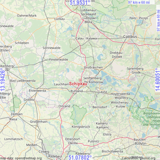
Schipkau GPS coordinates[2]
51° 31' 3.576" North, 13° 53' 50.568" East
| Map corner | latitude | longitude |
|---|---|---|
| Upper-left | 51.9531°, | 13.19426° |
| Center: | 51.51766°, | 13.89738° |
| Lower-right: | 51.07802°, | 14.60051° |
| Map W x H: | 97.3×97.3 km | = 60.5×60.5mi |
| max Lat: | 55.01917° ⇑33.5% North |
| Schipkau: | 51.51766° |
| min Lat: | ⇓66.5% South 47.40724° |
| min Long | Schipkau | max Long |
| 5.92978° | 13.89738° | 14.98853° |
| W 97.5%⇐ | ⇒2.5% E |
Elevation
Elevation of Schipkau is 113 m = 371 ft, and this is 136.1 m = 447 ft below average elevation for this country.
| Max E: |
1256 m = 4121 ft | 66.2% |
| Avg. | 249.1 m = 817 ft | |
| Schipkau | 113 m = 371 ft | |
Min E: |
-5 m = -16 ft | 33.8% |
See also: Germany elevation on elevation.city.
Geographical zone
Schipkau is located in North temperate zone (between Tropic of Cancer and the Arctic Circle). Distance of this North polar circle is 1672.9 km =1039.5 mi to North.| Distance of | km | miles | from Schipkau |
|---|---|---|---|
| North Pole | 4278.8 | 2658.7 | to North |
| Arctic Circle | 1672.9 | 1039.5 | to North |
| Tropic Cancer | 3122.3 | 1940.1 | to South |
| Equator | 5728.2 | 3559.3 | to South |


Nearby cities:
15 places around Schipkau: (largest is in red/bold)
• Frauendorf
14.5 km =9 mi,  217°
217°
• Großräschen
11.1 km =6.9 mi,  45°
45°
• Grünewald
14.9 km =9.3 mi,  151°
151°
• Guteborn
11.5 km =7.1 mi,  167°
167°
• Hermsdorf
12.5 km =7.8 mi,  181°
181°
• Hohenbocka
12.4 km =7.7 mi,  141°
141°
• Kroppen
16.4 km =10.2 mi,  204°
204°
• Lauchhammer
9.7 km =6 mi,  250°
250°
• Lichterfeld
12.1 km =7.5 mi,  317°
317°
• Ruhland
7 km =4.3 mi, 197°
• Sallgast
8.6 km =5.3 mi,  336°
336°
• Schwarzbach
7.9 km =4.9 mi,  161°
161°
• Schwarzheide
5.4 km =3.4 mi,  212°
212°
• Senftenberg
7.3 km =4.5 mi,  83°
83°
• Tettau
14.7 km =9.1 mi,  230°
230°
Sources, notices
• [Note1] Compared only with cities in Germany existing in our database
• [Src1] Map data: © OpenStreetMap contributors (CC-BY-SA)
• [Src2] Other city data from geonames.org with taken over terms of usage.
• [Src3] Geographical zone / Annual Mean Temperature by Robert A. Rohde @ Wikipedia
