Schwanfeld geodata
Schwanfeld (Bavaria) is a seat of a fourth-order administrative division; located in Germany in Europe/Berlin (GMT+2) time zone. With population of 2,032 people, there are 5019 cities with bigger population in this country. Compared to other cities in Germany, 65.8% of cities are located further ↑North; 52.3% of cities are located further ←West and 51.9% of cities have lower elevation than Schwanfeld. Note1
Administrative division(s):
- Level 1: Bavaria
- Level 2: Regierungsbezirk Unterfranken
- Level 3: Landkreis Schweinfurt
- Level 4: Schwanfeld


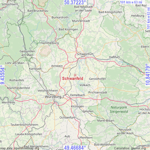
Schwanfeld GPS coordinates[2]
49° 55' 17.976" North, 10° 8' 19.176" East
| Map corner | latitude | longitude |
|---|---|---|
| Upper-left | 50.37223°, | 9.43554° |
| Center: | 49.92166°, | 10.13866° |
| Lower-right: | 49.46684°, | 10.84179° |
| Map W x H: | 100.7×100.7 km | = 62.6×62.6mi |
| max Lat: | 55.01917° ⇑65.8% North |
| Schwanfeld: | 49.92166° |
| min Lat: | ⇓34.2% South 47.40724° |
| min Long | Schwanfeld | max Long |
| 5.92978° | 10.13866° | 14.98853° |
| W 52.3%⇐ | ⇒47.7% E |
Elevation
Elevation of Schwanfeld is 239 m = 784 ft, and this is 10.1 m = 33 ft below average elevation for this country.
| Max E: |
1256 m = 4121 ft | 48.1% |
| Avg. | 249.1 m = 817 ft | |
| Schwanfeld | 239 m = 784 ft | |
Min E: |
-5 m = -16 ft | 51.9% |
See also: Germany elevation on elevation.city.
Geographical zone
Schwanfeld is located in North temperate zone (between Tropic of Cancer and the Arctic Circle). Distance of this North polar circle is 1850.4 km =1149.8 mi to North.| Distance of | km | miles | from Schwanfeld |
|---|---|---|---|
| North Pole | 4456.3 | 2769 | to North |
| Arctic Circle | 1850.4 | 1149.8 | to North |
| Tropic Cancer | 2944.8 | 1829.8 | to South |
| Equator | 5550.8 | 3449.1 | to South |


Nearby cities:
15 places around Schwanfeld: (largest is in red/bold)
• Bergrheinfeld
10.3 km =6.4 mi,  17°
17°
• Bergtheim
5.7 km =3.5 mi,  244°
244°
• Grafenrheinfeld
9.8 km =6.1 mi,  26°
26°
• Kolitzheim
6.8 km =4.2 mi,  94°
94°
• Kürnach
11 km =6.8 mi,  223°
223°
• Nordheim
7.8 km =4.8 mi,  154°
154°
• Oberpleichfeld
6.2 km =3.9 mi, 216°
• Prosselsheim
6.6 km =4.1 mi,  187°
187°
• Röthlein
8.8 km =5.5 mi,  39°
39°
• Schwebheim
10.9 km =6.8 mi,  45°
45°
• Unterpleichfeld
9 km =5.6 mi,  229°
229°
• Volkach
9.1 km =5.7 mi,  135°
135°
• Waigolshausen
4.9 km =3 mi,  344°
344°
• Werneck
7.3 km =4.5 mi, 336°
• Wipfeld
2.1 km =1.3 mi,  105°
105°
Sources, notices
• [Note1] Compared only with cities in Germany existing in our database
• [Src1] Map data: © OpenStreetMap contributors (CC-BY-SA)
• [Src2] Other city data from geonames.org with taken over terms of usage.
• [Src3] Geographical zone / Annual Mean Temperature by Robert A. Rohde @ Wikipedia
