Oberpleichfeld geodata
Oberpleichfeld (Bavaria) is a seat of a fourth-order administrative division; located in Germany in Europe/Berlin (GMT+2) time zone. With population of 1,051 people, there are 6997 cities with bigger population in this country. Compared to other cities in Germany, 67.1% of cities are located further ↑North; 51.5% of cities are located further ←West and 57.5% of cities have lower elevation than Oberpleichfeld. Note1
Administrative division(s):
- Level 1: Bavaria
- Level 2: Regierungsbezirk Unterfranken
- Level 3: Landkreis Würzburg
- Level 4: Oberpleichfeld


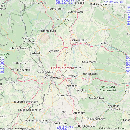
Oberpleichfeld GPS coordinates[2]
49° 52' 36.984" North, 10° 5' 12.552" East
| Map corner | latitude | longitude |
|---|---|---|
| Upper-left | 50.32793°, | 9.38369° |
| Center: | 49.87694°, | 10.08682° |
| Lower-right: | 49.4217°, | 10.78995° |
| Map W x H: | 100.8×100.8 km | = 62.6×62.6mi |
| max Lat: | 55.01917° ⇑67.1% North |
| Oberpleichfeld: | 49.87694° |
| min Lat: | ⇓32.9% South 47.40724° |
| min Long | Oberpleichfeld | max Long |
| 5.92978° | 10.08682° | 14.98853° |
| W 51.5%⇐ | ⇒48.5% E |
Elevation
Elevation of Oberpleichfeld is 275 m = 902 ft, and this is 25.9 m = 85 ft above average elevation for this country.
| Max E: |
1256 m = 4121 ft | 42.5% |
| Oberpleichfeld | 275 m 902 ft | |
| Avg. | 249.1 m = 817 ft | |
Min E: |
-5 m = -16 ft | 57.5% |
See also: Germany elevation on elevation.city.
Geographical zone
Oberpleichfeld is located in North temperate zone (between Tropic of Cancer and the Arctic Circle). Distance of this North polar circle is 1855.4 km =1152.9 mi to North.| Distance of | km | miles | from Oberpleichfeld |
|---|---|---|---|
| North Pole | 4461.3 | 2772.1 | to North |
| Arctic Circle | 1855.4 | 1152.9 | to North |
| Tropic Cancer | 2939.9 | 1826.8 | to South |
| Equator | 5545.8 | 3446 | to South |


Nearby cities:
15 places around Oberpleichfeld: (largest is in red/bold)
• Bergtheim
2.9 km =1.8 mi,  330°
330°
• Dettelbach
10 km =6.2 mi,  145°
145°
• Estenfeld
7.9 km =4.9 mi,  227°
227°
• Kolitzheim
11.4 km =7.1 mi,  67°
67°
• Kürnach
4.9 km =3 mi, 231°
• Nordheim
7.4 km =4.6 mi,  106°
106°
• Prosselsheim
3.2 km =2 mi,  118°
118°
• Rimpar
9.6 km =6 mi,  256°
256°
• Rottendorf
10.4 km =6.5 mi,  204°
204°
• Schwanfeld
6.2 km =3.9 mi,  36°
36°
• Sommerach
10.2 km =6.3 mi, 121°
• Unterpleichfeld
3.2 km =2 mi,  253°
253°
• Volkach
10.2 km =6.3 mi,  98°
98°
• Waigolshausen
10 km =6.2 mi,  13°
13°
• Wipfeld
7.2 km =4.5 mi,  52°
52°
Sources, notices
• [Note1] Compared only with cities in Germany existing in our database
• [Src1] Map data: © OpenStreetMap contributors (CC-BY-SA)
• [Src2] Other city data from geonames.org with taken over terms of usage.
• [Src3] Geographical zone / Annual Mean Temperature by Robert A. Rohde @ Wikipedia
