Schornsheim geodata
Schornsheim (Rheinland-Pfalz) is a seat of a fourth-order administrative division; located in Germany in Europe/Berlin (GMT+2) time zone. With population of 1,590 people, there are 5700 cities with bigger population in this country. Compared to other cities in Germany, 67.8% of cities are located further ↑North; 74.4% of cities are located further →East and 58.3% of cities have higher elevation than Schornsheim. Note1
Administrative division(s):
- Level 1: Rheinland-Pfalz
- Level 3: Landkreis Alzey-Worms
- Level 4: Schornsheim


Schornsheim GPS coordinates[2]
49° 50' 44.988" North, 8° 10' 30" East
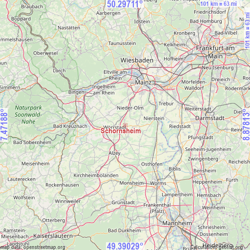
| Map corner | latitude | longitude |
|---|---|---|
| Upper-left | 50.29711°, | 7.47188° |
| Center: | 49.84583°, | 8.175° |
| Lower-right: | 49.39029°, | 8.87813° |
| Map W x H: | 100.8×100.8 km | = 62.6×62.6mi |
| max Lat: | 55.01917° ⇑67.8% North |
| Schornsheim: | 49.84583° |
| min Lat: | ⇓32.2% South 47.40724° |
| min Long | Schornsheim | max Long |
| 5.92978° | 8.175° | 14.98853° |
| W 25.6%⇐ | ⇒74.4% E |
Elevation
Elevation of Schornsheim is 165 m = 541 ft, and this is 84.1 m = 276 ft below average elevation for this country.
| Max E: |
1256 m = 4121 ft | 58.3% |
| Avg. | 249.1 m = 817 ft | |
| Schornsheim | 165 m = 541 ft | |
Min E: |
-5 m = -16 ft | 41.7% |
See also: Germany elevation on elevation.city.
Geographical zone
Schornsheim is located in North temperate zone (between Tropic of Cancer and the Arctic Circle). Distance of this North polar circle is 1858.8 km =1155 mi to North.| Distance of | km | miles | from Schornsheim |
|---|---|---|---|
| North Pole | 4464.7 | 2774.2 | to North |
| Arctic Circle | 1858.8 | 1155 | to North |
| Tropic Cancer | 2936.4 | 1824.6 | to South |
| Equator | 5542.3 | 3443.8 | to South |


Nearby cities:
15 places around Schornsheim: (largest is in red/bold)
• Bechtolsheim
4.8 km =3 mi,  163°
163°
• Biebelnheim
5.5 km =3.4 mi,  183°
183°
• Friesenheim
6 km =3.7 mi,  100°
100°
• Gabsheim
2 km =1.2 mi, 177°
• Hahnheim
4.7 km =2.9 mi,  69°
69°
• Köngernheim
5.1 km =3.2 mi,  90°
90°
• Ober-Saulheim
3.5 km =2.2 mi,  304°
304°
• Selzen
6 km =3.7 mi, 74°
• Spiesheim
5.2 km =3.2 mi,  220°
220°
• Sulzheim
6 km =3.7 mi,  267°
267°
• Sörgenloch
4.5 km =2.8 mi,  24°
24°
• Udenheim
2.1 km =1.3 mi,  353°
353°
• Undenheim
3.3 km =2.1 mi,  105°
105°
• Wörrstadt
3.7 km =2.3 mi, 274°
• Zornheim
6.1 km =3.8 mi,  35°
35°
Sources, notices
• [Note1] Compared only with cities in Germany existing in our database
• [Src1] Map data: © OpenStreetMap contributors (CC-BY-SA)
• [Src2] Other city data from geonames.org with taken over terms of usage.
• [Src3] Geographical zone / Annual Mean Temperature by Robert A. Rohde @ Wikipedia
