Schmiedeberg geodata
Schmiedeberg (Saxony) is a seat of a fourth-order administrative division; located in Germany in Europe/Berlin (GMT+2) time zone. With population of 4,806 people, there are 2899 cities with bigger population in this country. Compared to other cities in Germany, 55% of cities are located further ↓South; 96.7% of cities are located further ←West and 80.5% of cities have lower elevation than Schmiedeberg. Note1
Administrative division(s):
- Level 1: Saxony
- Level 3: Landkreis Sächsische Schweiz
- Level 4: Dippoldiswalde


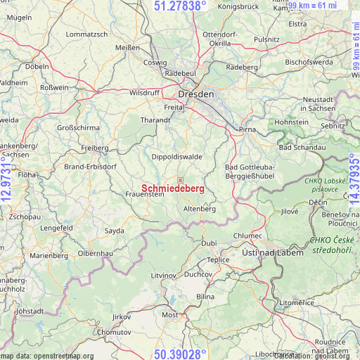
Schmiedeberg GPS coordinates[2]
50° 50' 11.184" North, 13° 40' 34.392" East
| Map corner | latitude | longitude |
|---|---|---|
| Upper-left | 51.27838°, | 12.9731° |
| Center: | 50.83644°, | 13.67622° |
| Lower-right: | 50.39028°, | 14.37935° |
| Map W x H: | 98.7×98.7 km | = 61.3×61.3mi |
| max Lat: | 55.01917° ⇑45% North |
| Schmiedeberg: | 50.83644° |
| min Lat: | ⇓55% South 47.40724° |
| min Long | Schmiedeberg | max Long |
| 5.92978° | 13.67622° | 14.98853° |
| W 96.7%⇐ | ⇒3.3% E |
Elevation
Elevation of Schmiedeberg is 436 m = 1430 ft, and this is 186.9 m = 613 ft above average elevation for this country.
| Max E: |
1256 m = 4121 ft | 19.5% |
| Schmiedeberg | 436 m 1430 ft | |
| Avg. | 249.1 m = 817 ft | |
Min E: |
-5 m = -16 ft | 80.5% |
See also: Germany elevation on elevation.city.
Geographical zone
Schmiedeberg is located in North temperate zone (between Tropic of Cancer and the Arctic Circle). Distance of this North polar circle is 1748.7 km =1086.6 mi to North.| Distance of | km | miles | from Schmiedeberg |
|---|---|---|---|
| North Pole | 4354.6 | 2705.8 | to North |
| Arctic Circle | 1748.7 | 1086.6 | to North |
| Tropic Cancer | 3046.6 | 1893.1 | to South |
| Equator | 5652.5 | 3512.3 | to South |


Nearby cities:
15 places around Schmiedeberg: (largest is in red/bold)
• Altenberg
9.6 km =6 mi,  145°
145°
• Bärenstein
9.4 km =5.8 mi,  114°
114°
• Dippoldiswalde
6.7 km =4.2 mi,  355°
355°
• Dorfhain
13.2 km =8.2 mi,  324°
324°
• Frauenstein
10.4 km =6.5 mi,  248°
248°
• Geising
12 km =7.5 mi,  137°
137°
• Glashütte
7.5 km =4.7 mi,  76°
76°
• Hermsdorf
10.5 km =6.5 mi,  23°
23°
• Kreischa
13.3 km =8.3 mi, 24°
• Liebstadt
13.1 km =8.1 mi, 76°
• Obercunnersdorf
12.1 km =7.5 mi, 317°
• Pretzschendorf
11.4 km =7.1 mi,  291°
291°
• Rabenau
14.5 km =9 mi,  350°
350°
• Rechenberg-Bienenmühle
14.8 km =9.2 mi,  222°
222°
• Reinhardtsgrimma
8.4 km =5.2 mi,  41°
41°
Sources, notices
• [Note1] Compared only with cities in Germany existing in our database
• [Src1] Map data: © OpenStreetMap contributors (CC-BY-SA)
• [Src2] Other city data from geonames.org with taken over terms of usage.
• [Src3] Geographical zone / Annual Mean Temperature by Robert A. Rohde @ Wikipedia
