Hermsdorf geodata
Hermsdorf (Saxony) is a populated place; located in Germany in Europe/Berlin (GMT+2) time zone. With population of 1,034 people, there are 7070 cities with bigger population in this country. Compared to other cities in Germany, 56.6% of cities are located further ↓South; 97% of cities are located further ←West and 72.6% of cities have lower elevation than Hermsdorf. Note1
Administrative division(s):
- Level 1: Saxony
- Level 3: Landkreis Sächsische Schweiz
- Level 4: Glashütte


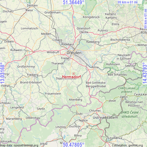
Hermsdorf GPS coordinates[2]
50° 55' 24.168" North, 13° 44' 5.28" East
| Map corner | latitude | longitude |
|---|---|---|
| Upper-left | 51.36449°, | 13.03168° |
| Center: | 50.92338°, | 13.7348° |
| Lower-right: | 50.47805°, | 14.43793° |
| Map W x H: | 98.6×98.6 km | = 61.3×61.3mi |
| max Lat: | 55.01917° ⇑43.4% North |
| Hermsdorf: | 50.92338° |
| min Lat: | ⇓56.6% South 47.40724° |
| min Long | Hermsdorf | max Long |
| 5.92978° | 13.7348° | 14.98853° |
| W 97%⇐ | ⇒3% E |
Elevation
Elevation of Hermsdorf is 379 m = 1243 ft, and this is 129.9 m = 426 ft above average elevation for this country.
| Max E: |
1256 m = 4121 ft | 27.4% |
| Hermsdorf | 379 m 1243 ft | |
| Avg. | 249.1 m = 817 ft | |
Min E: |
-5 m = -16 ft | 72.6% |
See also: Germany elevation on elevation.city.
Geographical zone
Hermsdorf is located in North temperate zone (between Tropic of Cancer and the Arctic Circle). Distance of this North polar circle is 1739 km =1080.6 mi to North.| Distance of | km | miles | from Hermsdorf |
|---|---|---|---|
| North Pole | 4344.9 | 2699.8 | to North |
| Arctic Circle | 1739 | 1080.6 | to North |
| Tropic Cancer | 3056.2 | 1899 | to South |
| Equator | 5662.1 | 3518.3 | to South |


Nearby cities:
15 places around Hermsdorf: (largest is in red/bold)
• Bannewitz
7.8 km =4.8 mi,  350°
350°
• Dippoldiswalde
5.5 km =3.4 mi,  236°
236°
• Dohma
13.9 km =8.6 mi,  93°
93°
• Dohna
9.4 km =5.8 mi,  67°
67°
• Dorfhain
11.8 km =7.3 mi,  275°
275°
• Freital
10.6 km =6.6 mi,  325°
325°
• Glashütte
8.5 km =5.3 mi,  158°
158°
• Heidenau
10.8 km =6.7 mi,  59°
59°
• Kreischa
2.8 km =1.7 mi,  30°
30°
• Liebstadt
10.8 km =6.7 mi,  127°
127°
• Obercunnersdorf
12.3 km =7.6 mi,  266°
266°
• Rabenau
7.9 km =4.9 mi,  305°
305°
• Reinhardtsgrimma
3.7 km =2.3 mi, 157°
• Schmiedeberg
10.5 km =6.5 mi,  203°
203°
• Tharandt
12.8 km =8 mi,  302°
302°
Sources, notices
• [Note1] Compared only with cities in Germany existing in our database
• [Src1] Map data: © OpenStreetMap contributors (CC-BY-SA)
• [Src2] Other city data from geonames.org with taken over terms of usage.
• [Src3] Geographical zone / Annual Mean Temperature by Robert A. Rohde @ Wikipedia
