Altenberg geodata
Altenberg (Saxony) is a populated place; located in Germany in Europe/Berlin (GMT+2) time zone. With population of 5,167 people, there are 2761 cities with bigger population in this country. Compared to other cities in Germany, 53.5% of cities are located further ↓South; 97.1% of cities are located further ←West and 98.7% of cities have lower elevation than Altenberg. Note1
Administrative division(s):
- Level 1: Saxony
- Level 3: Landkreis Sächsische Schweiz
- Level 4: Altenberg


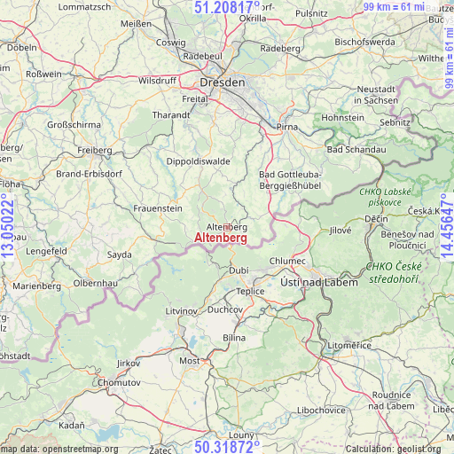
Altenberg GPS coordinates[2]
50° 45' 56.016" North, 13° 45' 12.024" East
| Map corner | latitude | longitude |
|---|---|---|
| Upper-left | 51.20817°, | 13.05022° |
| Center: | 50.76556°, | 13.75334° |
| Lower-right: | 50.31872°, | 14.45647° |
| Map W x H: | 98.9×98.9 km | = 61.5×61.5mi |
| max Lat: | 55.01917° ⇑46.5% North |
| Altenberg: | 50.76556° |
| min Lat: | ⇓53.5% South 47.40724° |
| min Long | Altenberg | max Long |
| 5.92978° | 13.75334° | 14.98853° |
| W 97.1%⇐ | ⇒2.9% E |
Elevation
Elevation of Altenberg is 753 m = 2470 ft, and this is 503.9 m = 1653 ft above average elevation for this country.
| Max E: |
1256 m = 4121 ft | 1.3% |
| Altenberg | 753 m 2470 ft | |
| Avg. | 249.1 m = 817 ft | |
Min E: |
-5 m = -16 ft | 98.7% |
See also: Germany elevation on elevation.city.
Geographical zone
Altenberg is located in North temperate zone (between Tropic of Cancer and the Arctic Circle). Distance of this North polar circle is 1756.6 km =1091.5 mi to North.| Distance of | km | miles | from Altenberg |
|---|---|---|---|
| North Pole | 4362.5 | 2710.7 | to North |
| Arctic Circle | 1756.6 | 1091.5 | to North |
| Tropic Cancer | 3038.7 | 1888.2 | to South |
| Equator | 5644.6 | 3507.4 | to South |


Nearby cities:
15 places around Altenberg: (largest is in red/bold)
• Bärenstein
5 km =3.1 mi,  38°
38°
• Dippoldiswalde
15.7 km =9.8 mi,  337°
337°
• Dohma
21 km =13 mi, 36°
• Dorfchemnitz
21.3 km =13.2 mi,  270°
270°
• Frauenstein
15.7 km =9.8 mi,  285°
285°
• Geising
2.9 km =1.8 mi,  108°
108°
• Glashütte
9.8 km =6.1 mi,  10°
10°
• Hermsdorf
17.6 km =10.9 mi,  355°
355°
• Kreischa
20 km =12.4 mi,  0°
0°
• Liebstadt
13.2 km =8.2 mi,  33°
33°
• Obercunnersdorf
21.6 km =13.4 mi,  321°
321°
• Pretzschendorf
20.1 km =12.5 mi,  306°
306°
• Rechenberg-Bienenmühle
15.7 km =9.8 mi,  258°
258°
• Reinhardtsgrimma
14.1 km =8.8 mi, 0°
• Schmiedeberg
9.6 km =6 mi,  325°
325°
Sources, notices
• [Note1] Compared only with cities in Germany existing in our database
• [Src1] Map data: © OpenStreetMap contributors (CC-BY-SA)
• [Src2] Other city data from geonames.org with taken over terms of usage.
• [Src3] Geographical zone / Annual Mean Temperature by Robert A. Rohde @ Wikipedia
