Frauenstein geodata
Frauenstein (Saxony) is a populated place; located in Germany in Europe/Berlin (GMT+2) time zone. With population of 3,364 people, there are 3709 cities with bigger population in this country. Compared to other cities in Germany, 54.3% of cities are located further ↓South; 96% of cities are located further ←West and 96.7% of cities have lower elevation than Frauenstein. Note1


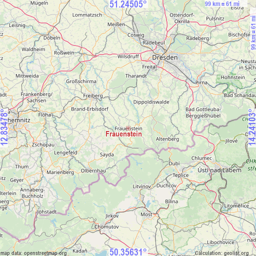
Frauenstein GPS coordinates[2]
50° 48' 10.044" North, 13° 32' 16.44" East
| Map corner | latitude | longitude |
|---|---|---|
| Upper-left | 51.24505°, | 12.83478° |
| Center: | 50.80279°, | 13.5379° |
| Lower-right: | 50.35631°, | 14.24103° |
| Map W x H: | 98.8×98.8 km | = 61.4×61.4mi |
| max Lat: | 55.01917° ⇑45.7% North |
| Frauenstein: | 50.80279° |
| min Lat: | ⇓54.3% South 47.40724° |
| min Long | Frauenstein | max Long |
| 5.92978° | 13.5379° | 14.98853° |
| W 96%⇐ | ⇒4% E |
Elevation
Elevation of Frauenstein is 650 m = 2133 ft, and this is 400.9 m = 1315 ft above average elevation for this country.
| Max E: |
1256 m = 4121 ft | 3.3% |
| Frauenstein | 650 m 2133 ft | |
| Avg. | 249.1 m = 817 ft | |
Min E: |
-5 m = -16 ft | 96.7% |
See also: Germany elevation on elevation.city.
Geographical zone
Frauenstein is located in North temperate zone (between Tropic of Cancer and the Arctic Circle). Distance of this North polar circle is 1752.4 km =1088.9 mi to North.| Distance of | km | miles | from Frauenstein |
|---|---|---|---|
| North Pole | 4358.3 | 2708.1 | to North |
| Arctic Circle | 1752.4 | 1088.9 | to North |
| Tropic Cancer | 3042.8 | 1890.7 | to South |
| Equator | 5648.7 | 3509.9 | to South |


Nearby cities:
15 places around Frauenstein: (largest is in red/bold)
• Altenberg
15.7 km =9.8 mi,  105°
105°
• Brand-Erbisdorf
16.7 km =10.4 mi,  295°
295°
• Dippoldiswalde
13.9 km =8.6 mi,  41°
41°
• Dorfchemnitz
7.4 km =4.6 mi,  236°
236°
• Dorfhain
14.7 km =9.1 mi,  7°
7°
• Großhartmannsdorf
14.4 km =8.9 mi,  268°
268°
• Heidersdorf
16.4 km =10.2 mi,  216°
216°
• Lichtenberg
8.7 km =5.4 mi,  294°
294°
• Mulda
8.7 km =5.4 mi, 273°
• Neuhausen
14.9 km =9.3 mi,  199°
199°
• Obercunnersdorf
12.8 km =8 mi, 7°
• Pretzschendorf
8 km =5 mi,  353°
353°
• Rechenberg-Bienenmühle
7.2 km =4.5 mi,  181°
181°
• Sayda
13.1 km =8.1 mi, 218°
• Schmiedeberg
10.4 km =6.5 mi,  68°
68°
Sources, notices
• [Note1] Compared only with cities in Germany existing in our database
• [Src1] Map data: © OpenStreetMap contributors (CC-BY-SA)
• [Src2] Other city data from geonames.org with taken over terms of usage.
• [Src3] Geographical zone / Annual Mean Temperature by Robert A. Rohde @ Wikipedia
