Hardt geodata
Hardt (Baden-Württemberg) is a seat of a fourth-order administrative division; located in Germany in Europe/Berlin (GMT+2) time zone. With population of 2,598 people, there are 4333 cities with bigger population in this country. Compared to other cities in Germany, 92.9% of cities are located further ↑North; 71.8% of cities are located further →East and 98.9% of cities have lower elevation than Hardt. Note1
Administrative division(s):
- Level 1: Baden-Württemberg
- Level 2: Freiburg Region
- Level 3: Landkreis Rottweil
- Level 4: Hardt


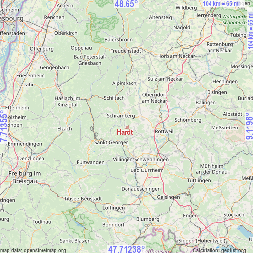
Hardt GPS coordinates[2]
48° 10' 59.988" North, 8° 25' 0.012" East
| Map corner | latitude | longitude |
|---|---|---|
| Upper-left | 48.65°, | 7.71355° |
| Center: | 48.18333°, | 8.41667° |
| Lower-right: | 47.71238°, | 9.1198° |
| Map W x H: | 104.3×104.3 km | = 64.8×64.8mi |
| max Lat: | 55.01917° ⇑92.9% North |
| Hardt: | 48.18333° |
| min Lat: | ⇓7.1% South 47.40724° |
| min Long | Hardt | max Long |
| 5.92978° | 8.41667° | 14.98853° |
| W 28.2%⇐ | ⇒71.8% E |
Elevation
Elevation of Hardt is 773 m = 2536 ft, and this is 523.9 m = 1719 ft above average elevation for this country.
| Max E: |
1256 m = 4121 ft | 1.1% |
| Hardt | 773 m 2536 ft | |
| Avg. | 249.1 m = 817 ft | |
Min E: |
-5 m = -16 ft | 98.9% |
See also: Germany elevation on elevation.city.
Geographical zone
Hardt is located in North temperate zone (between Tropic of Cancer and the Arctic Circle). Distance of this North polar circle is 2043.7 km =1269.9 mi to North.| Distance of | km | miles | from Hardt |
|---|---|---|---|
| North Pole | 4649.6 | 2889.1 | to North |
| Arctic Circle | 2043.7 | 1269.9 | to North |
| Tropic Cancer | 2751.6 | 1709.8 | to South |
| Equator | 5357.5 | 3329 | to South |


Nearby cities:
15 places around Hardt: (largest is in red/bold)
• Aichhalden
9.4 km =5.8 mi,  353°
353°
• Bösingen
11.3 km =7 mi,  60°
60°
• Dunningen
7.4 km =4.6 mi, 64°
• Königsfeld im Schwarzwald
5 km =3.1 mi,  177°
177°
• Lauterbach/Schwarzwald
7.6 km =4.7 mi,  313°
313°
• Mönchweiler
9.2 km =5.7 mi, 177°
• Niedereschach
10.3 km =6.4 mi,  122°
122°
• Sankt Georgen im Schwarzwald
8.7 km =5.4 mi,  224°
224°
• Schiltach
13 km =8.1 mi,  334°
334°
• Schramberg
5.1 km =3.2 mi, 333°
• Seedorf
9.1 km =5.7 mi,  36°
36°
• Tennenbronn
4.9 km =3 mi,  279°
279°
• Unterkirnach
12.2 km =7.6 mi,  198°
198°
• Villingendorf
12.5 km =7.8 mi,  81°
81°
• Zimmern ob Rottweil
13.3 km =8.3 mi,  98°
98°
Sources, notices
• [Note1] Compared only with cities in Germany existing in our database
• [Src1] Map data: © OpenStreetMap contributors (CC-BY-SA)
• [Src2] Other city data from geonames.org with taken over terms of usage.
• [Src3] Geographical zone / Annual Mean Temperature by Robert A. Rohde @ Wikipedia
