Scheer geodata
Scheer (Baden-Württemberg) is a populated place; located in Germany in Europe/Berlin (GMT+2) time zone. With population of 2,622 people, there are 4311 cities with bigger population in this country. Compared to other cities in Germany, 94.5% of cities are located further ↑North; 60.8% of cities are located further →East and 93.2% of cities have lower elevation than Scheer. Note1
Administrative division(s):
- Level 1: Baden-Württemberg
- Level 2: Tübingen Region
- Level 3: Landkreis Sigmaringen
- Level 4: Scheer


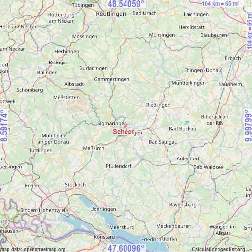
Scheer GPS coordinates[2]
48° 4' 22.512" North, 9° 17' 41.496" East
| Map corner | latitude | longitude |
|---|---|---|
| Upper-left | 48.54059°, | 8.59174° |
| Center: | 48.07292°, | 9.29486° |
| Lower-right: | 47.60096°, | 9.99799° |
| Map W x H: | 104.5×104.5 km | = 64.9×64.9mi |
| max Lat: | 55.01917° ⇑94.5% North |
| Scheer: | 48.07292° |
| min Lat: | ⇓5.5% South 47.40724° |
| min Long | Scheer | max Long |
| 5.92978° | 9.29486° | 14.98853° |
| W 39.2%⇐ | ⇒60.8% E |
Elevation
Elevation of Scheer is 561 m = 1841 ft, and this is 311.9 m = 1023 ft above average elevation for this country.
| Max E: |
1256 m = 4121 ft | 6.8% |
| Scheer | 561 m 1841 ft | |
| Avg. | 249.1 m = 817 ft | |
Min E: |
-5 m = -16 ft | 93.2% |
See also: Germany elevation on elevation.city.
Geographical zone
Scheer is located in North temperate zone (between Tropic of Cancer and the Arctic Circle). Distance of this North polar circle is 2056 km =1277.5 mi to North.| Distance of | km | miles | from Scheer |
|---|---|---|---|
| North Pole | 4661.9 | 2896.8 | to North |
| Arctic Circle | 2056 | 1277.5 | to North |
| Tropic Cancer | 2739.3 | 1702.1 | to South |
| Equator | 5345.2 | 3321.4 | to South |


Nearby cities:
15 places around Scheer: (largest is in red/bold)
• Altheim
13.9 km =8.6 mi,  54°
54°
• Bingen
4.6 km =2.9 mi,  338°
338°
• Ennetach
3 km =1.9 mi,  140°
140°
• Ertingen
13.1 km =8.1 mi,  76°
76°
• Herbertingen
10.3 km =6.4 mi,  93°
93°
• Hohentengen
7.8 km =4.8 mi,  128°
128°
• Inzigkofen
8.5 km =5.3 mi,  268°
268°
• Krauchenwies
7.2 km =4.5 mi,  209°
209°
• Langenenslingen
10.4 km =6.5 mi,  36°
36°
• Mengen
3.7 km =2.3 mi, 134°
• Neufra
14.8 km =9.2 mi,  65°
65°
• Ostrach
15.2 km =9.4 mi,  154°
154°
• Sigmaringen
5.1 km =3.2 mi,  289°
289°
• Sigmaringendorf
2.6 km =1.6 mi,  252°
252°
• Veringenstadt
14 km =8.7 mi,  333°
333°
Sources, notices
• [Note1] Compared only with cities in Germany existing in our database
• [Src1] Map data: © OpenStreetMap contributors (CC-BY-SA)
• [Src2] Other city data from geonames.org with taken over terms of usage.
• [Src3] Geographical zone / Annual Mean Temperature by Robert A. Rohde @ Wikipedia
