Bingen geodata
Bingen (Baden-Württemberg) is a seat of a fourth-order administrative division; located in Germany in Europe/Berlin (GMT+2) time zone. With population of 3,017 people, there are 3983 cities with bigger population in this country. Compared to other cities in Germany, 93.9% of cities are located further ↑North; 61.1% of cities are located further →East and 95.5% of cities have lower elevation than Bingen. Note1
Administrative division(s):
- Level 1: Baden-Württemberg
- Level 2: Tübingen Region
- Level 3: Landkreis Sigmaringen
- Level 4: Bingen


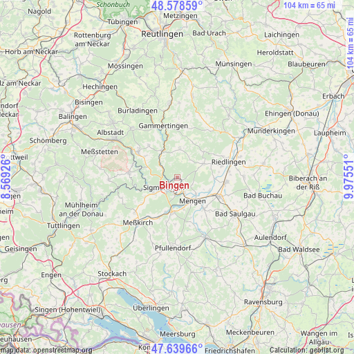
Bingen GPS coordinates[2]
48° 6' 40.572" North, 9° 16' 20.568" East
| Map corner | latitude | longitude |
|---|---|---|
| Upper-left | 48.57859°, | 8.56926° |
| Center: | 48.11127°, | 9.27238° |
| Lower-right: | 47.63966°, | 9.97551° |
| Map W x H: | 104.4×104.4 km | = 64.9×64.9mi |
| max Lat: | 55.01917° ⇑93.9% North |
| Bingen: | 48.11127° |
| min Lat: | ⇓6.1% South 47.40724° |
| min Long | Bingen | max Long |
| 5.92978° | 9.27238° | 14.98853° |
| W 38.9%⇐ | ⇒61.1% E |
Elevation
Elevation of Bingen is 610 m = 2001 ft, and this is 360.9 m = 1184 ft above average elevation for this country.
| Max E: |
1256 m = 4121 ft | 4.5% |
| Bingen | 610 m 2001 ft | |
| Avg. | 249.1 m = 817 ft | |
Min E: |
-5 m = -16 ft | 95.5% |
See also: Germany elevation on elevation.city.
Geographical zone
Bingen is located in North temperate zone (between Tropic of Cancer and the Arctic Circle). Distance of this North polar circle is 2051.7 km =1274.9 mi to North.| Distance of | km | miles | from Bingen |
|---|---|---|---|
| North Pole | 4657.6 | 2894.1 | to North |
| Arctic Circle | 2051.7 | 1274.9 | to North |
| Tropic Cancer | 2743.6 | 1704.8 | to South |
| Equator | 5349.5 | 3324 | to South |


Nearby cities:
15 places around Bingen: (largest is in red/bold)
• Altheim
13.5 km =8.4 mi,  73°
73°
• Ennetach
7.4 km =4.6 mi,  151°
151°
• Ertingen
14.5 km =9 mi,  94°
94°
• Herbertingen
12.9 km =8 mi,  112°
112°
• Hettingen
12 km =7.5 mi,  345°
345°
• Hohentengen
12 km =7.5 mi,  139°
139°
• Inzigkofen
8.2 km =5.1 mi,  236°
236°
• Krauchenwies
10.7 km =6.6 mi,  189°
189°
• Langenenslingen
8.8 km =5.5 mi,  62°
62°
• Mengen
8.1 km =5 mi, 148°
• Scheer
4.6 km =2.9 mi,  158°
158°
• Sigmaringen
4 km =2.5 mi,  230°
230°
• Sigmaringendorf
5.1 km =3.2 mi, 188°
• Veringenstadt
9.4 km =5.8 mi,  330°
330°
• Winterlingen
14.1 km =8.8 mi,  304°
304°
Sources, notices
• [Note1] Compared only with cities in Germany existing in our database
• [Src1] Map data: © OpenStreetMap contributors (CC-BY-SA)
• [Src2] Other city data from geonames.org with taken over terms of usage.
• [Src3] Geographical zone / Annual Mean Temperature by Robert A. Rohde @ Wikipedia
