Veringenstadt geodata
Veringenstadt (Baden-Württemberg) is a populated place; located in Germany in Europe/Berlin (GMT+2) time zone. With population of 2,332 people, there are 4631 cities with bigger population in this country. Compared to other cities in Germany, 92.8% of cities are located further ↑North; 62.2% of cities are located further →East and 96.7% of cities have lower elevation than Veringenstadt. Note1
Administrative division(s):
- Level 1: Baden-Württemberg
- Level 2: Tübingen Region
- Level 3: Landkreis Sigmaringen
- Level 4: Veringenstadt


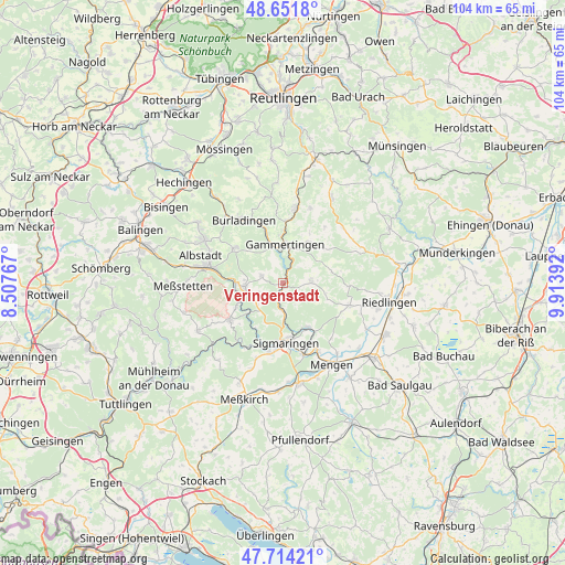
Veringenstadt GPS coordinates[2]
48° 11' 6.54" North, 9° 12' 38.844" East
| Map corner | latitude | longitude |
|---|---|---|
| Upper-left | 48.6518°, | 8.50767° |
| Center: | 48.18515°, | 9.21079° |
| Lower-right: | 47.71421°, | 9.91392° |
| Map W x H: | 104.3×104.2 km | = 64.8×64.7mi |
| max Lat: | 55.01917° ⇑92.8% North |
| Veringenstadt: | 48.18515° |
| min Lat: | ⇓7.2% South 47.40724° |
| min Long | Veringenstadt | max Long |
| 5.92978° | 9.21079° | 14.98853° |
| W 37.8%⇐ | ⇒62.2% E |
Elevation
Elevation of Veringenstadt is 651 m = 2136 ft, and this is 401.9 m = 1319 ft above average elevation for this country.
| Max E: |
1256 m = 4121 ft | 3.3% |
| Veringenstadt | 651 m 2136 ft | |
| Avg. | 249.1 m = 817 ft | |
Min E: |
-5 m = -16 ft | 96.7% |
See also: Germany elevation on elevation.city.
Geographical zone
Veringenstadt is located in North temperate zone (between Tropic of Cancer and the Arctic Circle). Distance of this North polar circle is 2043.5 km =1269.8 mi to North.| Distance of | km | miles | from Veringenstadt |
|---|---|---|---|
| North Pole | 4649.4 | 2889 | to North |
| Arctic Circle | 2043.5 | 1269.8 | to North |
| Tropic Cancer | 2751.8 | 1709.9 | to South |
| Equator | 5357.7 | 3329.1 | to South |


Nearby cities:
15 places around Veringenstadt: (largest is in red/bold)
• Bingen
9.4 km =5.8 mi,  150°
150°
• Bitz
11 km =6.8 mi,  306°
306°
• Burladingen
13.8 km =8.6 mi,  328°
328°
• Gammertingen
7.5 km =4.7 mi,  7°
7°
• Hettingen
3.8 km =2.4 mi,  24°
24°
• Inzigkofen
13 km =8.1 mi,  190°
190°
• Langenenslingen
13 km =8.1 mi,  108°
108°
• Neufra
7.3 km =4.5 mi,  343°
343°
• Scheer
14 km =8.7 mi, 153°
• Sigmaringen
10.9 km =6.8 mi,  172°
172°
• Sigmaringendorf
13.8 km =8.6 mi,  163°
163°
• Stetten am Kalten Markt
12 km =7.5 mi,  235°
235°
• Straßberg
8.9 km =5.5 mi,  264°
264°
• Trochtelfingen
13.9 km =8.6 mi, 10°
• Winterlingen
7 km =4.3 mi,  268°
268°
Sources, notices
• [Note1] Compared only with cities in Germany existing in our database
• [Src1] Map data: © OpenStreetMap contributors (CC-BY-SA)
• [Src2] Other city data from geonames.org with taken over terms of usage.
• [Src3] Geographical zone / Annual Mean Temperature by Robert A. Rohde @ Wikipedia
