Schalkham geodata
Schalkham (Bavaria) is a seat of a fourth-order administrative division; located in Germany in Europe/Berlin (GMT+2) time zone. With population of 898 people, there are 7531 cities with bigger population in this country. Compared to other cities in Germany, 89.3% of cities are located further ↑North; 87.1% of cities are located further ←West and 84.8% of cities have lower elevation than Schalkham. Note1
Administrative division(s):
- Level 1: Bavaria
- Level 2: Lower Bavaria
- Level 3: Landkreis Landshut
- Level 4: Schalkham


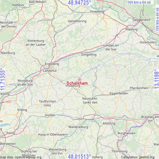
Schalkham GPS coordinates[2]
48° 28' 59.988" North, 12° 25' 0.012" East
| Map corner | latitude | longitude |
|---|---|---|
| Upper-left | 48.94725°, | 11.71355° |
| Center: | 48.48333°, | 12.41667° |
| Lower-right: | 48.01513°, | 13.1198° |
| Map W x H: | 103.6×103.6 km | = 64.4×64.4mi |
| max Lat: | 55.01917° ⇑89.3% North |
| Schalkham: | 48.48333° |
| min Lat: | ⇓10.7% South 47.40724° |
| min Long | Schalkham | max Long |
| 5.92978° | 12.41667° | 14.98853° |
| W 87.1%⇐ | ⇒12.9% E |
Elevation
Elevation of Schalkham is 467 m = 1532 ft, and this is 217.9 m = 715 ft above average elevation for this country.
| Max E: |
1256 m = 4121 ft | 15.2% |
| Schalkham | 467 m 1532 ft | |
| Avg. | 249.1 m = 817 ft | |
Min E: |
-5 m = -16 ft | 84.8% |
See also: Germany elevation on elevation.city.
Geographical zone
Schalkham is located in North temperate zone (between Tropic of Cancer and the Arctic Circle). Distance of this North polar circle is 2010.3 km =1249.1 mi to North.| Distance of | km | miles | from Schalkham |
|---|---|---|---|
| North Pole | 4616.2 | 2868.4 | to North |
| Arctic Circle | 2010.3 | 1249.1 | to North |
| Tropic Cancer | 2784.9 | 1730.5 | to South |
| Equator | 5390.8 | 3349.7 | to South |


Nearby cities:
15 places around Schalkham: (largest is in red/bold)
• Adlkofen
13.3 km =8.3 mi,  303°
303°
• Aham
5.8 km =3.6 mi,  34°
34°
• Bodenkirchen
11.4 km =7.1 mi,  192°
192°
• Egglkofen
9.6 km =6 mi,  165°
165°
• Frontenhausen
11 km =6.8 mi,  50°
50°
• Furth
9 km =5.6 mi,  196°
196°
• Gangkofen
12 km =7.5 mi,  115°
115°
• Geisenhausen
11.7 km =7.3 mi,  266°
266°
• Gerzen
2.7 km =1.7 mi,  15°
15°
• Loiching
14.9 km =9.3 mi,  4°
4°
• Marklkofen
13.3 km =8.3 mi,  56°
56°
• Neumarkt-Sankt Veit
15.2 km =9.4 mi,  153°
153°
• Niederaichbach
14.9 km =9.3 mi,  330°
330°
• Niederviehbach
15 km =9.3 mi,  350°
350°
• Vilsbiburg
5.6 km =3.5 mi,  232°
232°
Sources, notices
• [Note1] Compared only with cities in Germany existing in our database
• [Src1] Map data: © OpenStreetMap contributors (CC-BY-SA)
• [Src2] Other city data from geonames.org with taken over terms of usage.
• [Src3] Geographical zone / Annual Mean Temperature by Robert A. Rohde @ Wikipedia
