Niederviehbach geodata
Niederviehbach (Bavaria) is a seat of a fourth-order administrative division; located in Germany in Europe/Berlin (GMT+2) time zone. With population of 2,444 people, there are 4508 cities with bigger population in this country. Compared to other cities in Germany, 87.7% of cities are located further ↑North; 86.8% of cities are located further ←West and 71.1% of cities have lower elevation than Niederviehbach. Note1
Administrative division(s):
- Level 1: Bavaria
- Level 2: Lower Bavaria
- Level 3: Landkreis Dingolfing-Landau
- Level 4: Niederviehbach


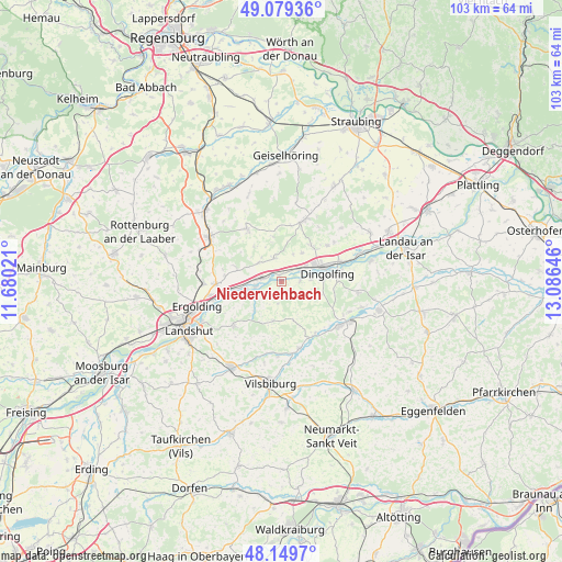
Niederviehbach GPS coordinates[2]
48° 37' 0.012" North, 12° 22' 59.988" East
| Map corner | latitude | longitude |
|---|---|---|
| Upper-left | 49.07936°, | 11.68021° |
| Center: | 48.61667°, | 12.38333° |
| Lower-right: | 48.1497°, | 13.08646° |
| Map W x H: | 103.4×103.4 km | = 64.2×64.2mi |
| max Lat: | 55.01917° ⇑87.7% North |
| Niederviehbach: | 48.61667° |
| min Lat: | ⇓12.3% South 47.40724° |
| min Long | Niederviehbach | max Long |
| 5.92978° | 12.38333° | 14.98853° |
| W 86.8%⇐ | ⇒13.2% E |
Elevation
Elevation of Niederviehbach is 367 m = 1204 ft, and this is 117.9 m = 387 ft above average elevation for this country.
| Max E: |
1256 m = 4121 ft | 28.9% |
| Niederviehbach | 367 m 1204 ft | |
| Avg. | 249.1 m = 817 ft | |
Min E: |
-5 m = -16 ft | 71.1% |
See also: Germany elevation on elevation.city.
Geographical zone
Niederviehbach is located in North temperate zone (between Tropic of Cancer and the Arctic Circle). Distance of this North polar circle is 1995.5 km =1239.9 mi to North.| Distance of | km | miles | from Niederviehbach |
|---|---|---|---|
| North Pole | 4601.4 | 2859.2 | to North |
| Arctic Circle | 1995.5 | 1239.9 | to North |
| Tropic Cancer | 2799.7 | 1739.7 | to South |
| Equator | 5405.7 | 3358.9 | to South |


Nearby cities:
15 places around Niederviehbach: (largest is in red/bold)
• Adlkofen
11.3 km =7 mi,  229°
229°
• Aham
11.5 km =7.1 mi,  150°
150°
• Bayerbach
11.6 km =7.2 mi,  327°
327°
• Dingolfing
8.5 km =5.3 mi,  70°
70°
• Essenbach
12.1 km =7.5 mi,  268°
268°
• Gerzen
12.6 km =7.8 mi,  165°
165°
• Gottfrieding
11.4 km =7.1 mi,  78°
78°
• Loiching
3.7 km =2.3 mi,  90°
90°
• Mengkofen
12.1 km =7.5 mi,  20°
20°
• Moosthenning
10.7 km =6.6 mi,  51°
51°
• Niederaichbach
5.2 km =3.2 mi,  249°
249°
• Postau
5.2 km =3.2 mi,  315°
315°
• Stallwang
12.9 km =8 mi,  239°
239°
• Weng
4.8 km =3 mi,  347°
347°
• Wörth an der Isar
3.3 km =2.1 mi,  282°
282°
Sources, notices
• [Note1] Compared only with cities in Germany existing in our database
• [Src1] Map data: © OpenStreetMap contributors (CC-BY-SA)
• [Src2] Other city data from geonames.org with taken over terms of usage.
• [Src3] Geographical zone / Annual Mean Temperature by Robert A. Rohde @ Wikipedia
