Eggstedt geodata
Eggstedt (Schleswig-Holstein) is a seat of a fourth-order administrative division; located in Germany in Europe/Berlin (GMT+2) time zone. With population of 858 people, there are 7673 cities with bigger population in this country. Compared to other cities in Germany, 93.3% of cities are located further ↓South; 61.3% of cities are located further →East and 98.6% of cities have higher elevation than Eggstedt. Note1
Administrative division(s):
- Level 1: Schleswig-Holstein
- Level 3: Kreis Dithmarschen
- Level 4: Eggstedt


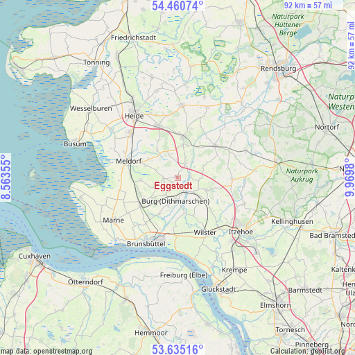
Eggstedt GPS coordinates[2]
54° 3' 0" North, 9° 16' 0.012" East
| Map corner | latitude | longitude |
|---|---|---|
| Upper-left | 54.46074°, | 8.56355° |
| Center: | 54.05°, | 9.26667° |
| Lower-right: | 53.63516°, | 9.9698° |
| Map W x H: | 91.8×91.8 km | = 57×57mi |
| max Lat: | 55.01917° ⇑6.7% North |
| Eggstedt: | 54.05° |
| min Lat: | ⇓93.3% South 47.40724° |
| min Long | Eggstedt | max Long |
| 5.92978° | 9.26667° | 14.98853° |
| W 38.7%⇐ | ⇒61.3% E |
Elevation
Elevation of Eggstedt is 1 m = 3 ft, and this is 248.1 m = 814 ft below average elevation for this country.
| Max E: |
1256 m = 4121 ft | 98.6% |
| Avg. | 249.1 m = 817 ft | |
| Eggstedt | 1 m = 3 ft | |
Min E: |
-5 m = -16 ft | 1.4% |
See also: Germany elevation on elevation.city.
Geographical zone
Eggstedt is located in North temperate zone (between Tropic of Cancer and the Arctic Circle). Distance of this North polar circle is 1391.4 km =864.6 mi to North.| Distance of | km | miles | from Eggstedt |
|---|---|---|---|
| North Pole | 3997.3 | 2483.8 | to North |
| Arctic Circle | 1391.4 | 864.6 | to North |
| Tropic Cancer | 3403.9 | 2115.1 | to South |
| Equator | 6009.8 | 3734.3 | to South |


Nearby cities:
15 places around Eggstedt: (largest is in red/bold)
• Besdorf
6.1 km =3.8 mi,  89°
89°
• Bornholt
7.1 km =4.4 mi,  38°
38°
• Brickeln
4.3 km =2.7 mi,  210°
210°
• Buchholz
7.4 km =4.6 mi,  202°
202°
• Burg
5.9 km =3.7 mi,  184°
184°
• Frestedt
5.7 km =3.5 mi,  251°
251°
• Gribbohm
5.8 km =3.6 mi,  114°
114°
• Großenrade
4.3 km =2.7 mi,  222°
222°
• Hochdonn
2.7 km =1.7 mi,  166°
166°
• Holstenniendorf
5.4 km =3.4 mi,  99°
99°
• Krumstedt
5.7 km =3.5 mi,  288°
288°
• Quickborn
5.8 km =3.6 mi, 220°
• Schafstedt
4.3 km =2.7 mi,  30°
30°
• Süderhastedt
3.9 km =2.4 mi,  269°
269°
• Tensbüttel-Röst
6 km =3.7 mi,  338°
338°
Sources, notices
• [Note1] Compared only with cities in Germany existing in our database
• [Src1] Map data: © OpenStreetMap contributors (CC-BY-SA)
• [Src2] Other city data from geonames.org with taken over terms of usage.
• [Src3] Geographical zone / Annual Mean Temperature by Robert A. Rohde @ Wikipedia
