Mauerstetten geodata
Mauerstetten (Bavaria) is a seat of a fourth-order administrative division; located in Germany in Europe/Berlin (GMT+2) time zone. With population of 2,922 people, there are 4069 cities with bigger population in this country. Compared to other cities in Germany, 96.7% of cities are located further ↑North; 62% of cities are located further ←West and 98.3% of cities have lower elevation than Mauerstetten. Note1
Administrative division(s):
- Level 1: Bavaria
- Level 2: Swabia
- Level 3: Landkreis Ostallgäu
- Level 4: Mauerstetten


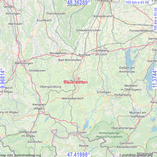
Mauerstetten GPS coordinates[2]
47° 53' 36.888" North, 10° 40' 16.572" East
| Map corner | latitude | longitude |
|---|---|---|
| Upper-left | 48.36289°, | 9.96814° |
| Center: | 47.89358°, | 10.67127° |
| Lower-right: | 47.41998°, | 11.3744° |
| Map W x H: | 104.8×104.8 km | = 65.1×65.1mi |
| max Lat: | 55.01917° ⇑96.7% North |
| Mauerstetten: | 47.89358° |
| min Lat: | ⇓3.3% South 47.40724° |
| min Long | Mauerstetten | max Long |
| 5.92978° | 10.67127° | 14.98853° |
| W 62%⇐ | ⇒38% E |
Elevation
Elevation of Mauerstetten is 725 m = 2379 ft, and this is 475.9 m = 1561 ft above average elevation for this country.
| Max E: |
1256 m = 4121 ft | 1.7% |
| Mauerstetten | 725 m 2379 ft | |
| Avg. | 249.1 m = 817 ft | |
Min E: |
-5 m = -16 ft | 98.3% |
See also: Germany elevation on elevation.city.
Geographical zone
Mauerstetten is located in North temperate zone (between Tropic of Cancer and the Arctic Circle). Distance of this North polar circle is 2075.9 km =1289.9 mi to North.| Distance of | km | miles | from Mauerstetten |
|---|---|---|---|
| North Pole | 4681.8 | 2909.1 | to North |
| Arctic Circle | 2075.9 | 1289.9 | to North |
| Tropic Cancer | 2719.3 | 1689.7 | to South |
| Equator | 5325.3 | 3309 | to South |


Nearby cities:
15 places around Mauerstetten: (largest is in red/bold)
• Baisweil
11.3 km =7 mi,  300°
300°
• Bidingen
8.2 km =5.1 mi,  149°
149°
• Biessenhofen
7.4 km =4.6 mi,  198°
198°
• Eggenthal
11.8 km =7.3 mi,  282°
282°
• Friesenried
10.4 km =6.5 mi,  258°
258°
• Ingenried
12 km =7.5 mi,  135°
135°
• Irsee
7.6 km =4.7 mi, 282°
• Kaufbeuren
3.9 km =2.4 mi,  251°
251°
• Oberostendorf
7.7 km =4.8 mi,  43°
43°
• Osterzell
6 km =3.7 mi,  100°
100°
• Pforzen
5.9 km =3.7 mi,  313°
313°
• Rieden
6.5 km =4 mi,  345°
345°
• Ruderatshofen
10.8 km =6.7 mi,  217°
217°
• Stöttwang
3.6 km =2.2 mi,  108°
108°
• Westendorf
5.6 km =3.5 mi, 37°
Sources, notices
• [Note1] Compared only with cities in Germany existing in our database
• [Src1] Map data: © OpenStreetMap contributors (CC-BY-SA)
• [Src2] Other city data from geonames.org with taken over terms of usage.
• [Src3] Geographical zone / Annual Mean Temperature by Robert A. Rohde @ Wikipedia
