Stöttwang geodata
Stöttwang (Bavaria) is a seat of a fourth-order administrative division; located in Germany in Europe/Berlin (GMT+2) time zone. With population of 1,847 people, there are 5279 cities with bigger population in this country. Compared to other cities in Germany, 96.9% of cities are located further ↑North; 62.7% of cities are located further ←West and 98.6% of cities have lower elevation than Stöttwang. Note1
Administrative division(s):
- Level 1: Bavaria
- Level 2: Swabia
- Level 3: Landkreis Ostallgäu
- Level 4: Stöttwang


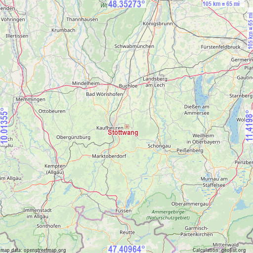
Stöttwang GPS coordinates[2]
47° 52' 59.988" North, 10° 43' 0.012" East
| Map corner | latitude | longitude |
|---|---|---|
| Upper-left | 48.35273°, | 10.01355° |
| Center: | 47.88333°, | 10.71667° |
| Lower-right: | 47.40964°, | 11.4198° |
| Map W x H: | 104.9×104.9 km | = 65.2×65.2mi |
| max Lat: | 55.01917° ⇑96.9% North |
| Stöttwang: | 47.88333° |
| min Lat: | ⇓3.1% South 47.40724° |
| min Long | Stöttwang | max Long |
| 5.92978° | 10.71667° | 14.98853° |
| W 62.7%⇐ | ⇒37.3% E |
Elevation
Elevation of Stöttwang is 740 m = 2428 ft, and this is 490.9 m = 1611 ft above average elevation for this country.
| Max E: |
1256 m = 4121 ft | 1.4% |
| Stöttwang | 740 m 2428 ft | |
| Avg. | 249.1 m = 817 ft | |
Min E: |
-5 m = -16 ft | 98.6% |
See also: Germany elevation on elevation.city.
Geographical zone
Stöttwang is located in North temperate zone (between Tropic of Cancer and the Arctic Circle). Distance of this North polar circle is 2077 km =1290.6 mi to North.| Distance of | km | miles | from Stöttwang |
|---|---|---|---|
| North Pole | 4682.9 | 2909.8 | to North |
| Arctic Circle | 2077 | 1290.6 | to North |
| Tropic Cancer | 2718.2 | 1689 | to South |
| Equator | 5324.1 | 3308.2 | to South |


Nearby cities:
15 places around Stöttwang: (largest is in red/bold)
• Bidingen
6 km =3.7 mi,  173°
173°
• Biessenhofen
8.2 km =5.1 mi,  224°
224°
• Denklingen
10.6 km =6.6 mi,  69°
69°
• Ingenried
8.9 km =5.5 mi,  146°
146°
• Irsee
11.1 km =6.9 mi,  284°
284°
• Kaufbeuren
7.1 km =4.4 mi,  269°
269°
• Mauerstetten
3.6 km =2.2 mi,  288°
288°
• Oberostendorf
7 km =4.3 mi,  16°
16°
• Osterzell
2.5 km =1.6 mi,  90°
90°
• Pforzen
9.3 km =5.8 mi,  304°
304°
• Rieden
8.9 km =5.5 mi,  326°
326°
• Ruderatshofen
12.4 km =7.7 mi,  233°
233°
• Schwabbruck
11 km =6.8 mi,  126°
126°
• Schwabsoien
10.3 km =6.4 mi,  122°
122°
• Westendorf
5.6 km =3.5 mi,  0°
0°
Sources, notices
• [Note1] Compared only with cities in Germany existing in our database
• [Src1] Map data: © OpenStreetMap contributors (CC-BY-SA)
• [Src2] Other city data from geonames.org with taken over terms of usage.
• [Src3] Geographical zone / Annual Mean Temperature by Robert A. Rohde @ Wikipedia
