Irsee geodata
Irsee (Bavaria) is a populated place; located in Germany in Europe/Berlin (GMT+2) time zone. With population of 1,345 people, there are 6191 cities with bigger population in this country. Compared to other cities in Germany, 96.6% of cities are located further ↑North; 60.2% of cities are located further ←West and 98.7% of cities have lower elevation than Irsee. Note1
Administrative division(s):
- Level 1: Bavaria
- Level 2: Swabia
- Level 3: Landkreis Ostallgäu
- Level 4: Irsee, Markt


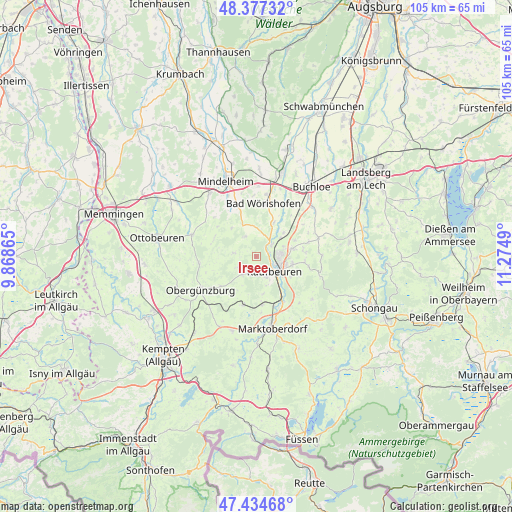
Irsee GPS coordinates[2]
47° 54' 29.34" North, 10° 34' 18.372" East
| Map corner | latitude | longitude |
|---|---|---|
| Upper-left | 48.37732°, | 9.86865° |
| Center: | 47.90815°, | 10.57177° |
| Lower-right: | 47.43468°, | 11.2749° |
| Map W x H: | 104.8×104.8 km | = 65.1×65.1mi |
| max Lat: | 55.01917° ⇑96.6% North |
| Irsee: | 47.90815° |
| min Lat: | ⇓3.4% South 47.40724° |
| min Long | Irsee | max Long |
| 5.92978° | 10.57177° | 14.98853° |
| W 60.2%⇐ | ⇒39.8% E |
Elevation
Elevation of Irsee is 746 m = 2448 ft, and this is 496.9 m = 1630 ft above average elevation for this country.
| Max E: |
1256 m = 4121 ft | 1.3% |
| Irsee | 746 m 2448 ft | |
| Avg. | 249.1 m = 817 ft | |
Min E: |
-5 m = -16 ft | 98.7% |
See also: Germany elevation on elevation.city.
Geographical zone
Irsee is located in North temperate zone (between Tropic of Cancer and the Arctic Circle). Distance of this North polar circle is 2074.3 km =1288.9 mi to North.| Distance of | km | miles | from Irsee |
|---|---|---|---|
| North Pole | 4680.2 | 2908.1 | to North |
| Arctic Circle | 2074.3 | 1288.9 | to North |
| Tropic Cancer | 2721 | 1690.8 | to South |
| Equator | 5326.9 | 3310 | to South |


Nearby cities:
15 places around Irsee: (largest is in red/bold)
• Aitrang
10.6 km =6.6 mi,  195°
195°
• Bad Wörishofen
11.1 km =6.9 mi,  9°
9°
• Baisweil
4.7 km =2.9 mi,  329°
329°
• Biessenhofen
10 km =6.2 mi,  149°
149°
• Dirlewang
11.6 km =7.2 mi, 333°
• Eggenthal
4.2 km =2.6 mi,  282°
282°
• Friesenried
4.6 km =2.9 mi,  216°
216°
• Kaufbeuren
4.7 km =2.9 mi,  127°
127°
• Mauerstetten
7.6 km =4.7 mi,  102°
102°
• Pforzen
3.9 km =2.4 mi,  52°
52°
• Rieden
7.5 km =4.7 mi, 51°
• Ruderatshofen
10.2 km =6.3 mi,  175°
175°
• Stöttwang
11.1 km =6.9 mi, 104°
• Unteregg
10.2 km =6.3 mi,  309°
309°
• Westendorf
11.2 km =7 mi,  75°
75°
Sources, notices
• [Note1] Compared only with cities in Germany existing in our database
• [Src1] Map data: © OpenStreetMap contributors (CC-BY-SA)
• [Src2] Other city data from geonames.org with taken over terms of usage.
• [Src3] Geographical zone / Annual Mean Temperature by Robert A. Rohde @ Wikipedia
