Rückersdorf geodata
Rückersdorf (Thuringia) is a seat of a fourth-order administrative division; located in Germany in Europe/Berlin (GMT+2) time zone. In our database, there are 11009 cities with bigger population. Compared to other cities in Germany, 54.7% of cities are located further ↓South; 84.9% of cities are located further ←West and 65.1% of cities have lower elevation than Rückersdorf. Note1


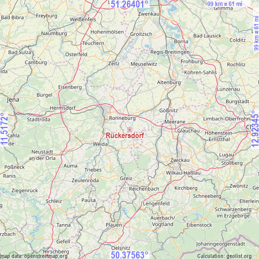
Rückersdorf GPS coordinates[2]
50° 49' 18.948" North, 12° 13' 13.152" East
| Map corner | latitude | longitude |
|---|---|---|
| Upper-left | 51.26401°, | 11.5172° |
| Center: | 50.82193°, | 12.22032° |
| Lower-right: | 50.37563°, | 12.92345° |
| Map W x H: | 98.8×98.8 km | = 61.4×61.4mi |
| max Lat: | 55.01917° ⇑45.3% North |
| Rückersdorf: | 50.82193° |
| min Lat: | ⇓54.7% South 47.40724° |
| min Long | Rückersdorf | max Long |
| 5.92978° | 12.22032° | 14.98853° |
| W 84.9%⇐ | ⇒15.1% E |
Elevation
Elevation of Rückersdorf is 322 m = 1056 ft, and this is 72.9 m = 239 ft above average elevation for this country.
| Max E: |
1256 m = 4121 ft | 34.9% |
| Rückersdorf | 322 m 1056 ft | |
| Avg. | 249.1 m = 817 ft | |
Min E: |
-5 m = -16 ft | 65.1% |
See also: Germany elevation on elevation.city.
Geographical zone
Rückersdorf is located in North temperate zone (between Tropic of Cancer and the Arctic Circle). Distance of this North polar circle is 1750.3 km =1087.6 mi to North.| Distance of | km | miles | from Rückersdorf |
|---|---|---|---|
| North Pole | 4356.2 | 2706.8 | to North |
| Arctic Circle | 1750.3 | 1087.6 | to North |
| Tropic Cancer | 3044.9 | 1892 | to South |
| Equator | 5650.9 | 3511.3 | to South |


Nearby cities:
15 places around Rückersdorf: (largest is in red/bold)
• Braunichswalde
2.5 km =1.6 mi,  186°
186°
• Endschütz
7.1 km =4.4 mi,  236°
236°
• Gauern
4.5 km =2.8 mi,  198°
198°
• Heukewalde
3.5 km =2.2 mi,  68°
68°
• Hilbersdorf
5 km =3.1 mi,  263°
263°
• Jonaswalde
5.7 km =3.5 mi,  77°
77°
• Korbussen
8.3 km =5.2 mi,  335°
335°
• Löbichau
8.6 km =5.3 mi,  20°
20°
• Nöbdenitz
6.7 km =4.2 mi,  41°
41°
• Paitzdorf
3.1 km =1.9 mi,  355°
355°
• Posterstein
5.9 km =3.7 mi,  33°
33°
• Ronneburg
5.2 km =3.2 mi,  332°
332°
• Seelingstädt
5.7 km =3.5 mi,  163°
163°
• Thonhausen
6.9 km =4.3 mi, 79°
• Vollmershain
6.4 km =4 mi,  60°
60°
Sources, notices
• [Note1] Compared only with cities in Germany existing in our database
• [Src1] Map data: © OpenStreetMap contributors (CC-BY-SA)
• [Src2] Other city data from geonames.org with taken over terms of usage.
• [Src3] Geographical zone / Annual Mean Temperature by Robert A. Rohde @ Wikipedia
