Seelingstädt geodata
Seelingstädt (Thuringia) is a seat of a fourth-order administrative division; located in Germany in Europe/Berlin (GMT+2) time zone. With population of 1,513 people, there are 5858 cities with bigger population in this country. Compared to other cities in Germany, 53.7% of cities are located further ↓South; 85.2% of cities are located further ←West and 62.2% of cities have lower elevation than Seelingstädt. Note1


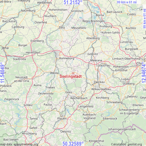
Seelingstädt GPS coordinates[2]
50° 46' 21.576" North, 12° 14' 36.996" East
| Map corner | latitude | longitude |
|---|---|---|
| Upper-left | 51.2152°, | 11.54049° |
| Center: | 50.77266°, | 12.24361° |
| Lower-right: | 50.32589°, | 12.94674° |
| Map W x H: | 98.9×98.9 km | = 61.5×61.5mi |
| max Lat: | 55.01917° ⇑46.3% North |
| Seelingstädt: | 50.77266° |
| min Lat: | ⇓53.7% South 47.40724° |
| min Long | Seelingstädt | max Long |
| 5.92978° | 12.24361° | 14.98853° |
| W 85.2%⇐ | ⇒14.8% E |
Elevation
Elevation of Seelingstädt is 303 m = 994 ft, and this is 53.9 m = 177 ft above average elevation for this country.
| Max E: |
1256 m = 4121 ft | 37.8% |
| Seelingstädt | 303 m 994 ft | |
| Avg. | 249.1 m = 817 ft | |
Min E: |
-5 m = -16 ft | 62.2% |
See also: Germany elevation on elevation.city.
Geographical zone
Seelingstädt is located in North temperate zone (between Tropic of Cancer and the Arctic Circle). Distance of this North polar circle is 1755.8 km =1091 mi to North.| Distance of | km | miles | from Seelingstädt |
|---|---|---|---|
| North Pole | 4361.7 | 2710.2 | to North |
| Arctic Circle | 1755.8 | 1091 | to North |
| Tropic Cancer | 3039.5 | 1888.7 | to South |
| Equator | 5645.4 | 3507.9 | to South |


Nearby cities:
15 places around Seelingstädt: (largest is in red/bold)
• Berga
6 km =3.7 mi,  247°
247°
• Braunichswalde
3.6 km =2.2 mi,  328°
328°
• Endschütz
7.7 km =4.8 mi,  281°
281°
• Gauern
3.3 km =2.1 mi,  291°
291°
• Heukewalde
6.9 km =4.3 mi,  13°
13°
• Hilbersdorf
8.2 km =5.1 mi,  306°
306°
• Jonaswalde
7.8 km =4.8 mi,  30°
30°
• Langenbernsdorf
6.1 km =3.8 mi,  107°
107°
• Leubnitz
9.7 km =6 mi,  124°
124°
• Neugernsdorf
9.9 km =6.2 mi,  231°
231°
• Paitzdorf
8.8 km =5.5 mi,  347°
347°
• Rückersdorf
5.7 km =3.5 mi,  343°
343°
• Teichwolframsdorf
5.8 km =3.6 mi,  177°
177°
• Thonhausen
8.5 km =5.3 mi,  37°
37°
• Vollmershain
9.5 km =5.9 mi,  24°
24°
Sources, notices
• [Note1] Compared only with cities in Germany existing in our database
• [Src1] Map data: © OpenStreetMap contributors (CC-BY-SA)
• [Src2] Other city data from geonames.org with taken over terms of usage.
• [Src3] Geographical zone / Annual Mean Temperature by Robert A. Rohde @ Wikipedia
